
Country United States FIPS code 19-74820 Elevation 365 m Population 470 (2013) Area code 641 | Time zone Central (CST) (UTC-6) GNIS feature ID 0461945 Zip code 50476 Local time Saturday 4:58 AM | |
 | ||
Weather 3°C, Wind NE at 24 km/h, 92% Humidity Area 137 ha (132 ha Land / 5 ha Water) | ||
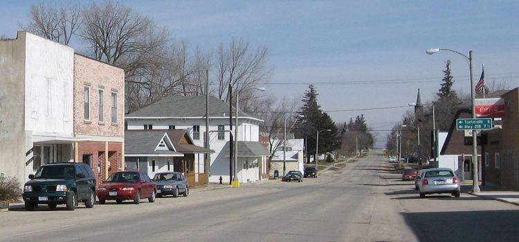
Stacyville is a city in Mitchell County, Iowa, United States. The population was 494 at the 2010 census.
Contents
Map of Stacyville, IA 50476, USA
History
Stacyville was platted in 1856. It was named for its founder, Homer I. Stacy.
Geography
Stacyville is located at 43°26′13″N 92°46′59″W (43.436910, -92.783011).
According to the United States Census Bureau, the city has a total area of 0.53 square miles (1.37 km2), of which, 0.51 square miles (1.32 km2) is land and 0.02 square miles (0.05 km2) is water.
2010 census
As of the census of 2010, there were 494 people, 223 households, and 123 families residing in the city. The population density was 968.6 inhabitants per square mile (374.0/km2). There were 255 housing units at an average density of 500.0 per square mile (193.1/km2). The racial makeup of the city was 97.4% White, 0.8% African American, 0.2% Native American, 0.4% Asian, 0.2% from other races, and 1.0% from two or more races. Hispanic or Latino of any race were 1.2% of the population.
There were 223 households of which 18.4% had children under the age of 18 living with them, 48.0% were married couples living together, 5.4% had a female householder with no husband present, 1.8% had a male householder with no wife present, and 44.8% were non-families. 39.0% of all households were made up of individuals and 26% had someone living alone who was 65 years of age or older. The average household size was 2.10 and the average family size was 2.80.
The median age in the city was 51 years. 18.4% of residents were under the age of 18; 6.4% were between the ages of 18 and 24; 17.3% were from 25 to 44; 24.6% were from 45 to 64; and 33.6% were 65 years of age or older. The gender makeup of the city was 49.2% male and 50.8% female.
2000 census
As of the census of 2000, there were 469 people, 211 households, and 121 families residing in the city. The population density was 1,055.9 people per square mile (411.5/km²). There were 228 housing units at an average density of 513.3 per square mile (200.1/km²). The racial makeup of the city was 99.79% White and 0.21% Asian.
There were 211 households out of which 19.4% had children under the age of 18 living with them, 50.2% were married couples living together, 3.3% had a female householder with no husband present, and 42.2% were non-families. 38.9% of all households were made up of individuals and 19.9% had someone living alone who was 65 years of age or older. The average household size was 2.03 and the average family size was 2.66.
In the city, the population was spread out with 19.4% under the age of 18, 3.0% from 18 to 24, 19.8% from 25 to 44, 20.5% from 45 to 64, and 37.3% who were 65 years of age or older. The median age was 54 years. For every 100 females there were 100.4 males. For every 100 females age 18 and over, there were 89.0 males.
The median income for a household in the city was $31,544, and the median income for a family was $36,944. Males had a median income of $26,528 versus $26,667 for females. The per capita income for the city was $16,831. About 2.6% of families and 6.6% of the population were below the poverty line, including 10.1% of those under age 18 and 1.5% of those age 65 or over.