
Structure type underground Disabled access Yes Level 2 | Platform levels 2 Province Ontario Tracks 4 (2 per line) | |
 | ||
Location 139 St. George Street
Toronto, Ontario
Canada Platforms 2 centre platforms (1 on each line) Connections TTC buses
26 Dupont
300 Bloor - Danforth Address X1R 5T7, Toronto, ON, Canada Similar Spadina, Downsview, Bloor–Yonge, Lawrence West, Osgoode | ||
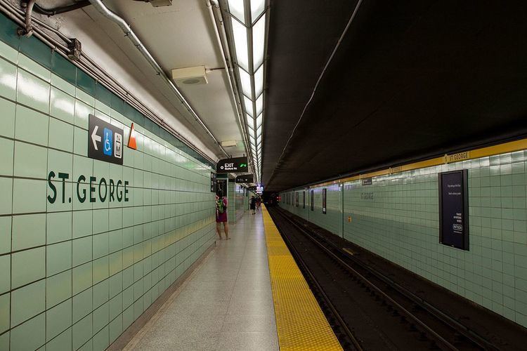
St. George is a station on the Yonge-University and Bloor-Danforth lines in Toronto, Ontario, Canada. It is located north of Bloor Street West between St. George Street and Bedford Road. This is the second-busiest station, after Bloor-Yonge Station, serving a combined total of approximately 276,260 people a day. Wi-fi service is available at this station.
Contents
Entrances
History
The station was first opened on February 28, 1963 for the University section of the Yonge-University line, followed by the Bloor-Danforth line on February 26, 1966, and finally on January 28, 1978 for the Spadina section of the former line.
Between 1963 and 1966, there was a direct surface connection at the Bedford Road subway entrance to Bloor and Danforth streetcars. The Bedford Loop was immediately south of the station structure and had opened in 1954 to provide a short turn facility for westbound streetcars serving Bloor station on the new Yonge Subway. Streetcars entered from Bedford Road, turned west into the loop beside the station, and exited south on to Bloor Street. The platform was on the east side of what is now the Ontario Institute for Studies in Education, with a TTC transformer station constructed at the former entrance and the exit where the Bloor - Bedford Parkette is situated. This loop gave passengers travelling in peak hours a more direct connection between the subway and eastbound and westbound streetcars than walking to/from the curbside stops. The loop closed in February 1966 when streetcar routes were replaced by the Bloor-Danforth Subway.
In 1999, this station became accessible with elevators.
Interlining
Bay and St. George stations each have four parallel tracks, two above two. Between these stations and Museum is a full double-track, grade-separated wye junction. The tracks to and from Museum connect to the upper St. George and Lower Bay stations, while the tracks along Bloor use lower St. George and upper Bay. From February to September 1966 all three sides of the wye were used in regular service: from each of three terminals — Eglinton, Keele, and Woodbine — trains ran alternately to the other two (between Eglinton and Museum they went via Union).
After the six months of interlining, the Bloor-Danforth Line became a separate route and lower Bay was closed. Upper St. George would become the terminus of the Yonge-University line until 1978, when the extension to Wilson was opened. Lower Bay is sometimes used as a movie or TV set, and has been used for platform-surface experiments.
Paul Arthur signage
Some areas of the station contain wayfinding signage with the image of a crest with a dragon, referencing the Christian legend of St. George. However, St. George Street is actually named for Quetton St. George, a French-born British citizen who lived in Toronto in the 19th century. The signs were designed by Paul Arthur and installed in 1993 as part of a new system of wayfinding signage, which was to be implemented in the entire subway system. Ultimately, the TTC did not go through with the project but did not remove the prototypes either, preserving some of Arthur's designs.
A further wayfinding project began implementation in 2014: using circles with the colour and number of each line to identify them more easily. Signage for that project rolled out at Bloor-Yonge station in March of that year, with St. George set to be the next to follow.
Subway infrastructure in the vicinity
Upon leaving the station, the line curves south by 90 degrees to run under Queen’s Park (the street). The two tracks split into separate tunnels in this area, briefly running at different levels to form a grade-separated junction with the second pair of link tracks from the Bloor-Danforth line, which curves in from the east.
Tenants
Nearby landmarks
Nearby landmarks include the Bata Shoe Museum, University of Toronto Schools, the north side of the University of Toronto, the Royal Conservatory of Music, the Chinese Consul General, and the York Club.