
Elevation 40 m | Max length 4.9 km | |
 | ||
Points of interest Unfinished Church, The Bermuda National, St Peter's Church - St George's, Somers Garden, StGeorges Historical Society M | ||
Fort st catherine st george s island bermuda
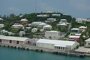
St. George's Island is one of the main islands of the territory of Bermuda. It lies in the northeast of the territory. It is divided between the town of St. George's and St. George's Parish. The island covers 703 acres (284.5 hectares), and is one of the six principal islands of Bermuda.
Contents
Map of St. George's Island, Bermuda
Originally called King's Island, it was the first part of Bermuda to be extensively colonised, and the town of St. George's contains many of the territory's oldest buildings. Notable among these are St. Peter's Church, and the State House, and many forts, including Gate's Fort. Fort St. Catherine, close to the island's (and Bermuda's) northernmost point, is a 19th-century construction built upon a 17th-century base. it is where the first English settlers ship wrecked in the sea venture in 1609.
The island is separated from the nearby St. David's Island by St. George's Harbor in the north, and by a channel known as Ferry Reach in the south. Bridges and a causeway connect it with the main island to the south via St. David's Island.
Education
Schools on the island: