
Platforms side platforms Disabled access Yes Opened 30 March 1954 Tracks 2 | Structure type underground Passengers (2014) 34,760 Province Ontario | |
 | ||
Location 15 St. Clair Avenue East
Toronto, Ontario
Canada Connections TTC buses and Streetcars
74 Mt Pleasant
88 South Leaside
97 Yonge
312 St Clair
320 Yonge
512 St Clair Address Toronto, ON M4T 1J8, Canada Similar Summerhill, Davisville, Eglinton West, Eglinton, Spadina | ||
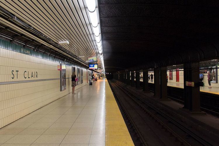
St. Clair is a subway station on the Yonge–University line in Toronto, Ontario, Canada. The station opened in 1954 as part of the original Yonge Street subway.
Contents
The station is located behind the buildings which front on the east side of Yonge Street. The main entrance is on the south side of St. Clair Avenue East, with the collectors booth, fare barrier and a McDonald's restaurant at street level, and a streetcar loop on the east side of the building. On the concourse level below that, at the south end of the station off Pleasant Boulevard, is a second staffed entrance and the bus platforms. The station has been fully accessible since 2007, with elevators, escalators and stairway connecting all levels. Wi-Fi service is available at this station.
Subway infrastructure in the vicinity
North of the station, the tunnel jogs west to cross to the west side of Yonge Street. At the Muir Portal the line runs in an open cut for 1.3 kilometres, between Yonge Street and the Davisville Yard, the TTC's original subway yard.
South of the station, the train continues to travel in a tunnel. Originally, the area south of the station was open-cut until Summerhill Avenue, immediately before Summerhill station; the line continued in open cut as far as Pleasant Boulevard, just before the next station to the north, St. Clair. Various sections of this open cut were roofed over as the years passed, and since the early 1980s it has been entirely under cover, except when one block was opened out and re-covered, to allow new construction above it. Passengers who look out into the tunnel on this section can still see the sloping sides of the original cut, the stumps of lamp posts and trees, and the undersides of four road bridges.
Nearby landmarks
Nearby landmarks include the David A. Balfour Park (Vale of Avoca section of Rosedale ravine), St. Michael's Cemetery, Deer Park, Moore Park, Upper Canada College, and Forest Hill.