
County Hamilton FIPS code 39-69470 Elevation 170 m Local time Friday 10:32 AM | State Ohio Time zone Eastern (EST) (UTC-5) GNIS feature ID 1045404 Population 4,350 (2013) | |
 | ||
Weather 13°C, Wind SW at 16 km/h, 88% Humidity Area 4.04 km² (4.014 km² Land / 3 ha Water) | ||
Mid day railfanning action in st bernard ohio 12 15 2016
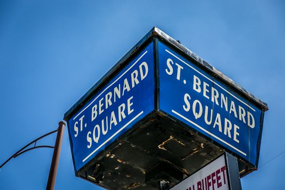
St. Bernard is a village in Hamilton County, Ohio, United States. The population was 4,368 at the 2010 census.
Contents
- Mid day railfanning action in st bernard ohio 12 15 2016
- Map of St Bernard OH USA
- Geography
- History
- 2010 census
- 2000 census
- Culture
- Education
- References
Map of St Bernard, OH, USA
Geography
St. Bernard is located at 39°10′4″N 84°29′42″W (39.167825, -84.495010), and along with Norwood and Elmwood Place, is an enclave surrounded by the city of Cincinnati.
According to the United States Census Bureau, the village has a total area of 1.56 square miles (4.04 km2), of which 1.55 square miles (4.01 km2) is land and 0.01 square miles (0.03 km2) is water.
History
St. Bernard was laid out in 1851 at the intersection of Main Street (now Vine Street, Cincinnati), the Miami and Erie Canal, and the Cincinnati, Hamilton and Dayton Railway. The town was originally built up chiefly by Germans.
St. Bernard was incorporated as a village in 1878. The oldest non profit social organization resides in St. Bernard - Idle Hour Social Club. State charted in 1913.
2010 census
As of the census of 2010, there were 4,368 people, 1,869 households, and 1,090 families residing in the village. The population density was 2,818.1 inhabitants per square mile (1,088.1/km2). There were 2,128 housing units at an average density of 1,372.9 per square mile (530.1/km2). The racial makeup of the village was 80.0% White, 15.7% African American, 0.3% Native American, 0.7% Asian, 0.1% Pacific Islander, 0.9% from other races, and 2.3% from two or more races. Hispanic or Latino of any race were 1.9% of the population.
There were 1,869 households of which 29.9% had children under the age of 18 living with them, 37.2% were married couples living together, 15.4% had a female householder with no husband present, 5.7% had a male householder with no wife present, and 41.7% were non-families. 36.2% of all households were made up of individuals and 12.8% had someone living alone who was 65 years of age or older. The average household size was 2.33 and the average family size was 3.08.
The median age in the village was 38.2 years. 23.6% of residents were under the age of 18; 10% were between the ages of 18 and 24; 25.1% were from 25 to 44; 28.2% were from 45 to 64; and 13% were 65 years of age or older. The gender makeup of the village was 47.2% male and 52.8% female.
2000 census
As of the census of 2000, there were 4,924 people, 2,069 households, and 1,251 families residing in the village. The population density was 3,196.1 people per square mile (1,234.5/km²). There were 2,195 housing units at an average density of 1,424.7/sq mi (550.3/km²). The racial makeup of the village was 91.41% White, 6.46% African American, 0.18% Native American, 0.63% Asian, 0.02% Pacific Islander, 0.43% from other races, and 0.87% from two or more races. Hispanic or Latino of any race were 0.65% of the population.
There were 2,069 households out of which 29.5% had children under the age of 18 living with them, 41.0% were married couples living together, 14.4% had a female householder with no husband present, and 39.5% were non-families. 34.5% of all households were made up of individuals and 14.5% had someone living alone who was 65 years of age or older. The average household size was 2.38 and the average family size was 3.09.
In the village, the population was spread out with 25.4% under the age of 18, 9.5% from 18 to 24, 29.3% from 25 to 44, 20.3% from 45 to 64, and 15.5% who were 65 years of age or older. The median age was 36 years. For every 100 females there were 90.9 males. For every 100 females age 18 and over, there were 84.2 males.
The median income for a household in the village was $37,356, and the median income for a family was $45,366. Males had a median income of $35,095 versus $26,672 for females. The per capita income for the village was $18,036. About 7.3% of families and 8.7% of the population were below the poverty line, including 7.6% of those under age 18 and 11.8% of those age 65 or over.
Culture
Several statues of St. Bernard dogs are located in the town.
The village's largest restaurant is Chili Time, a local Cincinnati chili parlor like many neighborhood establishments in the Cincinnati area.
The village operates the "Dial-A-Ride" bus program. The town is home to several clubs and organizations such as the Women's' Club, The R & L Club,The local Eagles Club, Kiwanis Club, and the oldest club in the area the Idle Hour Social Club, founded there in 1913. The Idle Hour Social Club prides itself as the oldest state chartered non profit organization in the State of Ohio.
Education
St. Bernard has a joint public school district with the neighboring Village of Elmwood Place called the St. Bernard-Elmwood Place Village Schools, allowing both neighborhoods to keep their school separate from Cincinnati schools. The district has three public schools: St. Bernard Elementary, Elmwood Elementary and St. Bernard High School. The athletics mascot of the district is the Titan.
St. Clement Elementary and Roger Bacon High School are also located in St. Bernard.
St. Bernard is served by a branch of the Public Library of Cincinnati and Hamilton County.