
Sovereign state United Kingdom Region East of England Admin HQ Bury St Edmunds Administrative center Bury St Edmunds Team Bury Town F.C. | Constituent country England Non-metropolitan county Suffolk Area 657 km² University West Suffolk College | |
 | ||
Status Non-metropolitan district Points of interest St Edmundsbury Cathedral, Ickworth House, West Stow Anglo‑Saxon Village, St Mary's Church - Bury St E, Bradfield Woods | ||
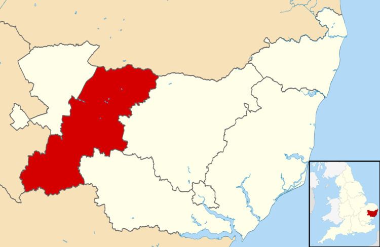
St Edmundsbury is a local government district and borough in Suffolk, England. It is named after its main town, Bury St Edmunds. The second town in the district is Haverhill. The population of the district was 111,008 at the 2011 Census.
Map of St. Edmundsbury District, UK
The district was formed on 1 April 1974 under the Local Government Act 1972 (with the abolition of West Suffolk) by the merger of the Borough of Bury St Edmunds, Haverhill Urban District, Clare Rural District and Thingoe Rural District.
Until March 2009, its main offices were in Bury St Edmunds (Angel Hill and Western Way). Thereafter, a purpose built complex, West Suffolk House housed both St Edmundsbury and Suffolk County Council staff.
In 2008, the Council submitted a proposal to the Boundary Commission which would see it as central to a new West Suffolk unitary council. Despite the considerable energies used to promote this concept the proposal was rejected and no unitary scheme for Suffolk was adopted. (For more details see also Suffolk.)
In October 2011, St Edmundsbury Borough Council and Forest Heath District Council agreed to have one chief executive, a shared management team and a combined workforce, creating initial savings of more than £2million.