
Country United States FIPS code 53-67175 Elevation 580 m Population 429 (2013) Local time Thursday 1:43 AM | Time zone Pacific (PST) (UTC-8) GNIS feature ID 1508614 Area 163 ha Zip code 99032 Area code 509 | |
 | ||
Weather 6°C, Wind SW at 14 km/h, 87% Humidity | ||
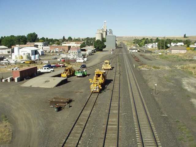
Sprague washington sprague lake aerial footage
Sprague is a city in Lincoln County, Washington, United States. The population was 446 at the 2010 census. The town was plotted in 1880 and named for former American Civil War Union general John Wilson Sprague.
Contents
- Sprague washington sprague lake aerial footage
- Map of Sprague WA 99032 USA
- History
- The Sprague Catholic Cemetery
- Geography
- Climate
- 2010 census
- 2000 census
- References
Map of Sprague, WA 99032, USA
Eugene E. Lindsey, World War II naval hero, was born in Sprague.
History
Sprague was first settled by William Newman, who established an inn at the location.
Sprague was officially incorporated on November 28, 1883. Originally called Hoodooville after William Burrows, a local character called Hoodoo Billy, the name was changed to honor General John W. Sprague, a railroad executive.
Sprague was destroyed by fire on August 3, 1895. The fire and subsequent decision by the Northern Pacific Railroad to not rebuild in the town resulted in the relocation of the county seat, held by Sprague after an election in 1884, to Davenport in 1896 after a controversial vote.
Mary Queen of Heaven Catholic Church in Sprague, Washington was originally built in 1883. The current church was built in a Gothic Revival style and erected in 1902, just south of the site of the original church and blessed by the Bishop of Nesqually. It was placed on the National Register of Historic Places by the U.S. Department of Interior in 1990.
The town has a seasonal creek running through it named "Negro Creek." Much debate has occurred regarding the creek's name but the name remains.
The Sprague Catholic Cemetery
The Sprague Catholic Cemetery is associated with and maintained by the Mary Queen of Heaven Parish Church. Those buried in this historic cemetery include lifetime residents of Sprague as well as immigrants born as long ago as the 1850s. The first burial took place on December 25; Mr. and Mrs. Mike Ferrell buried their infant daughter Margaret Mabel Farrell. The Farrells later donated the plot of land their daughter was buried on to the Catholic Church. It was dedicated by Bishop Junger of Nesqually Diocese.
Geography
Sprague is located at 47°17′56″N 117°58′39″W (47.298974, -117.977532).
According to the United States Census Bureau, the city has a total area of 0.63 square miles (1.63 km2), all of it land.
Climate
According to the Köppen climate classification system, Sprague has a dry-summer humid continental climate, abbreviated "Dsb" on climate maps, Just barely escaping a semi-arid climate.
2010 census
As of the census of 2010, there were 446 people, 197 households, and 128 families residing in the city. The population density was 707.9 inhabitants per square mile (273.3/km2). There were 236 housing units at an average density of 374.6 per square mile (144.6/km2). The racial makeup of the city was 94.2% White, 2.0% Native American, 1.6% Asian, 0.4% from other races, and 1.8% from two or more races. Hispanic or Latino of any race were 3.6% of the population.
There were 197 households of which 26.4% had children under the age of 18 living with them, 51.8% were married couples living together, 9.1% had a female householder with no husband present, 4.1% had a male householder with no wife present, and 35.0% were non-families. 32.5% of all households were made up of individuals and 15.2% had someone living alone who was 65 years of age or older. The average household size was 2.26 and the average family size was 2.81.
The median age in the city was 46.5 years. 23.1% of residents were under the age of 18; 4.9% were between the ages of 18 and 24; 19.9% were from 25 to 44; 32.5% were from 45 to 64; and 19.5% were 65 years of age or older. The gender makeup of the city was 51.1% male and 48.9% female.
2000 census
As of the census of 2000, there were 490 people, 216 households, and 130 families residing in the city. The population density was 780.8 people per square mile (300.3/km²). There were 242 housing units at an average density of 385.6 per square mile (148.3/km²). The racial makeup of the city was 93.47% White, 2.65% Native American, 0.41% Asian, 1.63% from other races, and 1.84% from two or more races. Hispanic or Latino of any race were 2.65% of the population.
There were 216 households out of which 26.4% had children under the age of 18 living with them, 49.5% were married couples living together, 7.4% had a female householder with no husband present, and 39.4% were non-families. 32.9% of all households were made up of individuals and 14.4% had someone living alone who was 65 years of age or older. The average household size was 2.27 and the average family size was 2.92.
In the city, the population was spread out with 24.5% under the age of 18, 6.5% from 18 to 24, 21.6% from 25 to 44, 26.3% from 45 to 64, and 21.0% who were 65 years of age or older. The median age was 43 years. For every 100 females there were 95.2 males. For every 100 females age 18 and over, there were 91.7 males.
The median income for a household in the city was $29,079, and the median income for a family was $31,750. Males had a median income of $30,833 versus $21,875 for females. The per capita income for the city was $15,912. About 8.9% of families and 13.2% of the population were below the poverty line, including 21.4% of those under age 18 and 6.6% of those age 65 or over.