
Country United States County Middlesex Time zone Eastern (EST) (UTC-5) Elevation 11 m Population 8,402 (2013) | State New Jersey Incorporated May 12, 1908 Area 6.402 km² Zip code 08884 Local time Thursday 3:58 AM | |
 | ||
Area rank 375th of 566 in state
20th of 25 in county Weather 2°C, Wind N at 5 km/h, 63% Humidity Area code 251.416723 (732 Exchanges) | ||
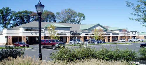
Spotswood is a borough in Middlesex County, New Jersey, United States. As of the 2010 United States Census, the borough's population was 8,257, reflecting an increase of 377 (+4.8%) from the 7,880 counted in the 2000 Census, which had in turn declined by 103 (−1.3%) from the 7,983 counted in the 1990 Census.
Contents
- Map of Spotswood NJ USA
- History
- Geography
- Census 2010
- Census 2000
- Government
- Local government
- Federal state and county representation
- Politics
- Education
- Roads and highways
- Public transportation
- References
Map of Spotswood, NJ, USA
History
Its first settler James Johnston originally called the place "Spottiswoode", named for his old place of residence in Scotland, and dates back to its original settlement in 1685.
Spotswood was incorporated as a borough by an act of the New Jersey Legislature on April 15, 1908, from portions of East Brunswick Township, based on the passage of a referendum held on May 12, 1908.
Geography
According to the United States Census Bureau, the borough had a total area of 2.472 square miles (6.402 km2), including 2.267 square miles (5.872 km2) of land and 0.205 square miles (0.531 km2) of water (8.29%). To the north east edge lies Duhernal Lake.
Unincorporated communities, localities and place names located partially or completely within the township include Outcalt, which is located along the border of Spotswood and Monroe Township.
The borough borders the Middlesex County municipalities of East Brunswick Township, Helmetta, Monroe Township and Old Bridge Township.
Census 2010
The 2010 United States Census counted 8,257 people, 3,128 households, and 2,143 families residing in the borough. The population density was 3,642.2 per square mile (1,406.3/km2). The borough contained 3,242 housing units at an average density of 1,430.1 per square mile (552.2/km2). The racial makeup of the borough was 88.63% (7,318) White, 2.98% (246) Black or African American, 0.11% (9) Native American, 5.14% (424) Asian, 0.01% (1) Pacific Islander, 1.27% (105) from other races, and 1.87% (154) from two or more races. Hispanics or Latinos of any race were 8.32% (687) of the population.
Out of a total of 3,128 households, 29.3% had children under the age of 18 living with them, 55.0% were married couples living together, 9.7% had a female householder with no husband present, and 31.5% were non-families. 27.1% of all households were made up of individuals, and 15.1% had someone living alone who was 65 years of age or older. The average household size was 2.56 and the average family size was 3.16.
In the borough, 21.1% of the population were under the age of 18, 6.9% from 18 to 24, 24.3% from 25 to 44, 28.8% from 45 to 64, and 18.9% who were 65 years of age or older. The median age was 43.5 years. For every 100 females the census counted 91.7 males, but for 100 females at least 18 years old, it was 86.1 males.
The Census Bureau's 2006–2010 American Community Survey showed that (in 2010 inflation-adjusted dollars) median household income was $70,360 (with a margin of error of +/- $9,861) and the median family income was $90,652 (+/- $8,741). Males had a median income of $59,226 (+/- $4,823) versus $43,365 (+/- $4,935) for females. The per capita income for the borough was $31,249 (+/- $1,696). About 2.5% of families and 3.3% of the population were below the poverty line, including 0.7% of those under age 18 and 6.4% of those age 65 or over.
Census 2000
As of the 2000 United States Census there were 7,880 people, 3,099 households, and 2,163 families residing in the borough. The population density was 3,389.8 people per square mile (1,311.4/km2). There were 3,158 housing units at an average density of 1,358.5 per square mile (525.6/km2). The racial makeup of the borough was 99.24% White, .05% African American, .5% Asian, 0.01% Pacific Islander, and 0.20% from two or more races. Hispanic or Latino of any race were 4.38% of the population.
There were 3,099 households out of which 29.4% had children under the age of 18 living with them, 57.0% were married couples living together, 9.1% had a female householder with no husband present, and 30.2% were non-families. 26.5% of all households were made up of individuals and 15.6% had someone living alone who was 65 years of age or older. The average household size was 2.54 and the average family size was 3.10.
In the borough the population was spread out with 22.4% under the age of 18, 6.8% from 18 to 24, 30.1% from 25 to 44, 23.4% from 45 to 64, and 17.4% who were 65 years of age or older. The median age was 40 years. For every 100 females there were 93.6 males. For every 100 females age 18 and over, there were 89.9 males.
The median income for a household in the borough was $55,833, and the median income for a family was $73,062. Males had a median income of $45,979 versus $35,859 for females. The per capita income for the borough was $25,247. About 2.6% of families and 4.3% of the population were below the poverty line, including 5.4% of those under age 18 and 2.9% of those age 65 or over.
Government
The Spotswood Police Department is a 24/7 law enforcement agency that serves the entire town. It currently has 18 officers and 4 dispatchers led by Chief Michael Zarro.
Local government
The Borough of Spotswood operates within the Faulkner Act (formally known as the Optional Municipal Charter Law of 1950) under the Mayor-Council (Plan B), implemented based on the recommendations of a Charter Study Commission as of July 1, 1976. The mayor and the five-member council are elected at-large on a non-partisan basis with each elected official serving four-year terms of office on a staggered basis, with either three council seats or two council seats and the mayoral seat up for vote every other year as part of the November general election. The mayor is the chief executive and has responsibility for the administration of the government. The legislative power resides solely within the borough council. There is separation of legislative and executive power in this form of government.
As of 2016, the Mayor of Spotswood is Nicholas Poliseno whose term of office ends December 31, 2016. Members of the Borough Council are Council President Curtis Stollen (2018), Margaret Drozd (2018), Theodore "Ted" Ricci (2018), Edward T. Seely (2016) and Leo B. Servis Jr. (2016; appointed to serve an unexpired term).
In May 2015, Councilmember Frank LoSacco resigned from office from a term expiring in December 2016. In the November 2015 general election, Servis was elected to serve the balance of the term of office and was sworn in at the December 7, 2015, meeting after the election results were certified.
Citing potential savings of $25,000, Spotswood's council approved a measure in 2010 that would allow the borough to take advantage of new state legislation under which it would to shift its non-partisan municipal elections from May to the November general election, with the first municipal race taking place in November 2012. In the November 2012 general election, Nicholas Poliseno defeated Curtis Stollen in the mayoral race to succeed Thomas W. Barlow, who didn't run for re-election. Council incumbents Frank LoSacco and Edward T. Seely ran unopposed.
Federal, state and county representation
Spotswood is located in the 12th Congressional District and is part of New Jersey's 14th state legislative district. Prior to the 2011 reapportionment following the 2010 Census, Spotswood had been in the 18th state legislative district.
New Jersey's Twelfth Congressional District is represented by Bonnie Watson Coleman (D, Ewing Township). New Jersey is represented in the United States Senate by Cory Booker (D, Newark, term ends 2021) and Bob Menendez (D, Paramus, 2019).
For the 2016–2017 session (Senate, General Assembly), the 14th Legislative District of the New Jersey Legislature is represented in the State Senate by Linda R. Greenstein (D, Plainsboro Township) and in the General Assembly by Daniel R. Benson (D, Hamilton Township, Mercer County) and Wayne DeAngelo (D, Hamilton Township). The Governor of New Jersey is Chris Christie (R, Mendham Township). The Lieutenant Governor of New Jersey is Kim Guadagno (R, Monmouth Beach).
Middlesex County is governed by a Board of Chosen Freeholders, whose seven members are elected at-large on a partisan basis to serve three-year terms of office on a staggered basis, with either two or three seats coming up for election each year as part of the November general election. At an annual reorganization meeting held in January, the board selects from among its members a Freeholder Director and Deputy Director. As of 2015, Middlesex County's Freeholders (with party affiliation, term-end year, residence and committee chairmanship listed in parentheses) are Freeholder Director Ronald G. Rios (D, term ends December 31, 2015, Carteret; Ex-officio on all committees), Freeholder Deputy Director Carol Barrett Bellante (D, 2017; Monmouth Junction, South Brunswick Township; County Administration), Kenneth Armwood (D, 2016, Piscataway; Business Development and Education), Charles Kenny ( D, 2016, Woodbridge Township; Finance), H. James Polos (D, 2015, Highland Park; Public Safety and Health), Charles E. Tomaro (D, 2017, Edison; Infrastructure Management) and Blanquita B. Valenti (D, 2016, New Brunswick; Community Services). Constitutional officers are County Clerk Elaine M. Flynn (D, Old Bridge Township), Sheriff Mildred S. Scott (D, 2016, Piscataway) and Surrogate Kevin J. Hoagland (D, 2017; New Brunswick).
Politics
As of March 23, 2011, there were a total of 5,119 registered voters in Spotswood, of which 1,485 (29.0%) were registered as Democrats, 965 (18.9%) were registered as Republicans and 2,667 (52.1%) were registered as Unaffiliated. There were 2 voters registered to other parties.
In the 2012 presidential election, Republican Mitt Romney received 50.1% of the vote (1,764 cast), ahead of Democrat Barack Obama with 48.6% (1,712 votes), and other candidates with 1.4% (48 votes), among the 3,557 ballots cast by the borough's 5,177 registered voters (33 ballots were spoiled), for a turnout of 68.7%. In the 2008 presidential election, Republican John McCain received 52.4% of the vote (2,001 cast), ahead of Democrat Barack Obama with 45.4% (1,734 votes) and other candidates with 1.7% (64 votes), among the 3,820 ballots cast by the borough's 5,217 registered voters, for a turnout of 73.2%. In the 2004 presidential election, Republican George W. Bush received 55.4% of the vote (2,014 ballots cast), outpolling Democrat John Kerry with 43.4% (1,580 votes) and other candidates with 0.7% (34 votes), among the 3,638 ballots cast by the borough's 4,952 registered voters, for a turnout percentage of 73.5.
In the 2013 gubernatorial election, Republican Chris Christie received 70.2% of the vote (1,591 cast), ahead of Democrat Barbara Buono with 28.3% (640 votes), and other candidates with 1.5% (34 votes), among the 2,290 ballots cast by the borough's 5,254 registered voters (25 ballots were spoiled), for a turnout of 43.6%. In the 2009 gubernatorial election, Republican Chris Christie received 63.2% of the vote (1,627 ballots cast), ahead of Democrat Jon Corzine with 28.6% (736 votes), Independent Chris Daggett with 6.4% (165 votes) and other candidates with 1.2% (31 votes), among the 2,576 ballots cast by the borough's 5,043 registered voters, yielding a 51.1% turnout.
Education
The Spotswood Public Schools serve students in pre-kindergarten through twelfth grade. As of the 2014-15 school year, the district and its four schools had an enrollment of 1,523 students and 149.9 classroom teachers (on an FTE basis), for a student–teacher ratio of 10.2:1. Schools in the district (with 2014-15 enrollment data from the National Center for Education Statistics) are G. Austin Schoenly Elementary School for Pre-K to 1st grade (257 students), E. Raymond Appleby Elementary School for grades 2-5 (459), Spotswood Memorial Middle School for grades 6-8 (316) and Spotswood High School for grades 9-12 (735).
Students from Helmetta, a non-operating district, attend school in Spotswood beginning in grammar school. Students from Milltown attend the high school as part of a sending/receiving relationship with the Milltown Public Schools.
Immaculate Conception Pre-School (toddler-PreK) and Immaculate Conception School (K-8), which opened in September 1960, operate under the supervision of Roman Catholic Diocese of Metuchen.
Roads and highways
As of July 2015, the borough had a total of 29.51 miles (47.49 km) of roadways, of which 25.52 miles (41.07 km) were maintained by the municipality and 4.07 miles (6.55 km) by Middlesex County.
The main roads that pass through Spotswood include Middlesex CR 613 (Devoe Avenue / Main Street / Summerhill Road) connecting Monroe Township to the south and East Brunswick Township to the north and Middlesex CR 615 (Manalapan Road / Main Street) connecting Helmetta in the southwest to East Brunswick Township in the borough's northwest corner.
Both Route 18 and CR 527 just miss the borough by less than a mile. The closest limited access is the New Jersey Turnpike (Interstate 95) which is accessible in both neighboring East Brunswick Township (Exit 9) and bordering Monroe Township (Exit 8A).
Public transportation
NJ Transit provides bus service between the borough and the Port Authority Bus Terminal in Midtown Manhattan on the 138 route.