
Country United States City St. Louis ZIP code(s) Parts of 63110, 63139 Area 223 ha Area code 314 | State Missouri Wards 8, 10, 24 Website stlouis-mo.gov Population 4,885 (2010) | |
 | ||
Restaurants Three Flags Tavern, Cunetto House of Pasta, O'Connell's Pub, Amigo Joe's Mexican, Sandrina's | ||
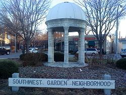
Southwest Garden is a neighborhood of St. Louis, Missouri.
Contents
Map of Southwest Garden, St. Louis, MO, USA
About
The Southwest Garden District is a horse head-shaped neighborhood between The Hill and Tower Grove Park. It is bordered by Southwest, I-44 and Columbia Ave. to the North, Tower Grove Avenue and Kingshighway to the East, Hampton Avenue to the West, and Magnolia, Connecticut and Scanlan Avenue to the South.
Southwest Garden is represented by the Aldermen of Wards 8, 10 and 24.
History
Southwest Garden west of Kingshighway has a history similar to its more famous neighbor The Hill. After the "Great Fire" of 1848 destroyed large parts of St. Louis, an ordinance banning frame construction put a premium on brick construction. The demand for brick spurred the mining of clay deposits that had been found west of Kingshighway in the 1830s. As the mines attracted immigrant miners, they began to settle nearby areas.
The establishment of St. Aloysius Gonzaga parish in 1892 helped further spur settlement. As a historically German parish, St. Aloysius Gonzaga represented and attracted more Germans. The parish was located at Magnolia and January Avenues. It was razed in 2006. St. Aloysius Gonzaga served as a counterpoint and rival to the Italian St. Ambrose on The Hill; the parishes reflect the different ethnic makeup of the two neighborhoods.
Southwest Garden east of Kingshighway is on land originally purchased by Henry Shaw in the 1850s.
Demographics
In 2010 Southwest Garden's racial makeup was 76.9% White, 16.5% Black, 0.3% Native American, 3.0% Asian, 2.4% Two or More Races, and 1.0% Some Other Race. 3.4% of the people were of Hispanic or Latino origin.