
Country Canada Established 1879 Local time Tuesday 10:18 AM Province New Brunswick | County Northumberland Time zone AST (UTC-4) Population 1,833 (2011) | |
 | ||
Weather -4°C, Wind E at 11 km/h, 89% Humidity | ||
Southesk is a Canadian parish in Northumberland County, New Brunswick.
Contents
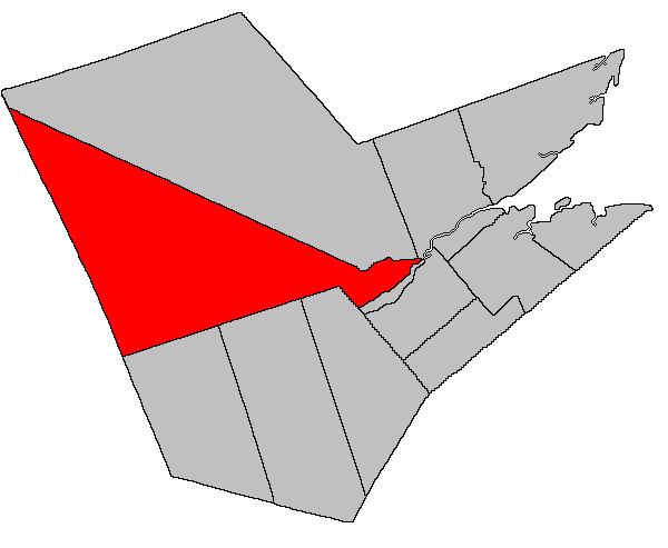
Map of Southesk, NB, Canada
Its population in the 2011 Census was 1,833.
Delineation
Southesk Parish is defined in the Territorial Division Act as being bounded:
Beginning at the northwest angle of the lot of land at Beaubears Point granted to the St. James Church of Scotland; thence westerly in a direct line, a distance of one hundred and sixteen chains or to the southeast angle of the northwest part of Lot Letter C, conveyed by Thomas Young and wife to William Goodfellow, by deed dated October 30th, 1922, (Registered Northumberland County Records Vol. 110 pages 434-435); thence in a westerly direction along the southern limit of said part of said lot to the southwest angle thereof; thence in a northerly direction along the western limit of the said lot to the southern limit of Williamstown or Kelly Road; thence in a westerly direction along said limit to the western limit of Lot Letter E, granted to James Oxford; thence in a northerly direction along said limit to the southern limit of Lot Number Thirteen, granted to Matthew Oxford; thence in a southwesterly direction along said limit to the most southerly angle of said lot; thence in a northwesterly direction along the southwestern limit of said lot and its prolongation to the most northerly angle of Lot Letter F, granted to Jared Betts; thence in a southwesterly direction along the north limit of said lot to its northwest angle; thence in a southerly direction along the west limit of said lot to the northern limit of lots fronting on the southwest Miramichi River; thence in a westerly direction along said limit to the easterly limit of lot Number One, granted to John Clark; thence in a northerly direction along said limit to the northeast angle of said lot; thence in a westerly direction along the northern limit of said lot and its prolongation to the northwest angle of Lot Number Two granted to Hannah Mullany; thence in a southerly direction along the western limit of said lot to the northeast angle of Lot Letter K, granted to John McIntire; thence in a westerly direction along the northern limit of said lot to its northwest angle; thence in a southerly direction along the western limit of said lot to the northeast angle of Lot Number Two, granted to William Smith; thence in a westerly direction to the southeast angle of the lot granted to William A. Bryenton; thence in a northerly direction along the eastern limit of said lot to its northeast angle; thence in a westerly direction along the northern limit of said lot to its northwest angle; thence in a southerly direction along the western limit of said lot to the northern limit of Lot Number Forty-one, granted to Timothy Crocker; thence in a westerly direction along said limit to the eastern limit of Lot Number Four, granted to Patrick Lawlor; thence in a northerly direction along said limit and said limit of Lot Number Five, granted to Rowland Crocker to the northeast angle of the last-mentioned lot; thence in a westerly direction along the northern limit of said lot to its northwest angle; thence westerly in a direct line to the northeast angle of the Elm Tree Tract, granted to William Davidson; thence in a westerly direction along the northern limit of said lot and its prolongation to intersect the northerly prolongation of the line run by H. E. Tait, New Brunswick Land Surveyor, in the year 1948, as part of the line dividing the Parish of Blackville from the Parishes of Derby and Nelson; thence northerly along the said prolongation to a point distant five hundred and thirty-seven chains measured northerly along said line and said prolongation from the centre line of the Canadian National Railway; thence by a true or Astronomic Bearing south seventy-two degrees and twenty minutes west to the County Line; thence in a northwesterly direction along the County Line to the southwestern limit of the Parish of Northesk; thence in a southeasterly direction along said limit to the Northwest Miramichi River; and thence in an easterly direction down stream to the place of beginning.Governance
The entire parish forms the local service district of the parish of South Esk, established in 1968 to assess for fire protection. First aid and ambulance services were added 1972.
Communities
Parish population total does not include incorporated municipalities (in bold) and communities within their respective boundaries (in italics).
References
Southesk Parish, New Brunswick Wikipedia(Text) CC BY-SA