
Country United States Time zone Central (CST) (UTC-6) Elevation 336 m Zip code 68776 Population 13,424 (2013) | Incorporated 1887 FIPS code 31-46030 Area 13.47 km² Local time Tuesday 12:01 AM Area code 402 | |
 | ||
Weather 4°C, Wind E at 2 km/h, 89% Humidity | ||
South Sioux City is a city in Dakota County, Nebraska, United States. It is located immediately across the Missouri River from Sioux City, Iowa, and is part of the Sioux City, IA-NE-SD Metropolitan Statistical Area. As of the 2010 census, the city population was 13,353, making it the 14th largest city in Nebraska.
Contents
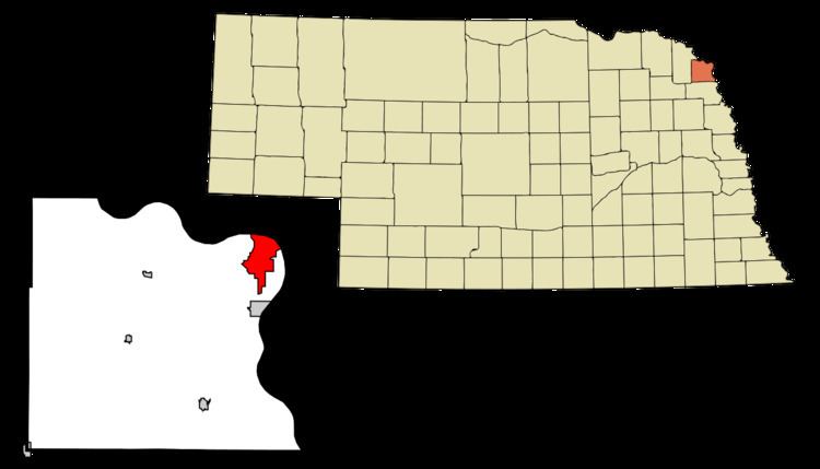
- Map of South Sioux City NE USA
- History
- Geography
- 2010 census
- 2000 census
- Arts and culture
- Highways
- Public transit
- Aviation
- References
Map of South Sioux City, NE, USA
History
Meriwether Lewis and William Clark passed through the South Sioux City area in 1804.
European settlement on the Nebraska side of the river began as early as 1854. Several town sites were platted and incorporated in the 1850s. Pacific City, incorporated in 1858, was a short-lived settlement. Covington and South Covington, both incorporated in 1857, merged in 1870. Another town, Stanton, was founded in 1856.
South Sioux City was incorporated in 1887. A special election in 1893 approved the merger of Covington and Stanton into the city of South Sioux City.
Geography
South Sioux City is located at 42°28′16″N 96°24′53″W (42.471095, -96.414732).
According to the United States Census Bureau, the city has a total area of 5.96 square miles (15.44 km2), of which, 5.71 square miles (14.79 km2) is land and 0.25 square miles (0.65 km2) is water.
In contrast to its hilly larger neighbor, South Sioux City is relatively flat. The difference in elevation across most of the city is less than 20 feet, generally ranging between 1,085 and 1,105 feet above sea level.
2010 census
As of the census of 2010, there were 13,353 people, 4,512 households, and 3,139 families residing in the city. The population density was 2,338.5 inhabitants per square mile (902.9/km2). There were 4,739 housing units at an average density of 829.9 per square mile (320.4/km2). The racial makeup of the city was 62.7% White, 4.7% African American, 3.0% Native American, 2.9% Asian, 0.2% Pacific Islander, 23.8% from other races, and 2.8% from two or more races. Hispanic or Latino of any race were 45.3% of the population.
There were 4,512 households of which 42.7% had children under the age of 18 living with them, 47.5% were married couples living together, 14.9% had a female householder with no husband present, 7.1% had a male householder with no wife present, and 30.4% were non-families. 25.0% of all households were made up of individuals and 10.4% had someone living alone who was 65 years of age or older. The average household size was 2.93 and the average family size was 3.51.
The median age in the city was 30.5 years. 31.4% of residents were under the age of 18; 10.4% were between the ages of 18 and 24; 26.1% were from 25 to 44; 21.8% were from 45 to 64; and 10.4% were 65 years of age or older. The gender makeup of the city was 49.6% male and 50.4% female.
2000 census
As of the census of 2000, there were 11,925 people, 4,304 households, and 2,961 families residing in the city. Of the 11,925 people, 48.6% are male and 51.4% are female. The population density was 2,431.6 people per square mile (939.6/km²). There were 4,557 housing units at an average density of 929.2 per square mile (359.1/km²). The racial makeup of the city was 75.9% White, 0.9% African American, 2.36% Native American, 3.19% Asian, 0.09% Pacific Islander, 14.57% from other races, and 3.05% from two or more races. Hispanic or Latino of any race were 24.8% of the population.
There were 4,304 households out of which 38.9% had children under the age of 18 living with them, 49.7% were married couples living together, 13.7% had a female householder with no husband present, and 31.2% were non-families. 25.6% of all households were made up of individuals and 10.3% had someone living alone who was 65 years of age or older. The average household size was 2.72 and the average family size was 3.26.
In the city, the population was spread out with 29.8% under the age of 18, 11.1% from 18 to 24, 29.6% from 25 to 44, 19.2% from 45 to 64, and 10.4% who were 65 years of age or older. The median age was 31 years. For every 100 females there were 94.6 males. For every 100 females age 18 and over, there were 92.0 males.
The median income for a household in the city was $36,493, and the median income for a family was $42,712. Males had a median income of $27,259 versus $21,709 for females. The per capita income for the city was $16,165. About 10.1% of families and 11.5% of the population were below the poverty line, including 14.9% of those under age 18 and 8.3% of those age 65 or over.
72.7% of the population held a high school diploma or higher; 12.7% held a bachelor's degree or higher; and 4.8% held a graduate or professional degree. 4.1% of the population were unemployed. Employed residents traveled an average of 15.3 minutes to their jobs.
Arts and culture
Highways
Several highways serve South Sioux City:
Public transit
Local bus service to South Sioux City is provided by the Sioux City Transit System.
Aviation
The nearest commercial airport is Sioux Gateway Airport/Colonel Bud Day Field (SUX) in Sioux City. A smaller general-aviation airport, Martin Field (7K8), is located just west of South Sioux City along U.S. Highway 20.