
Length .85 mi (1.37 km) Status unknown | ||
 | ||
Similar Grasshopper Glacier, Sacagawea Glacier, Minor Glacier, Knife Point Glacier, Mammoth Glacier | ||
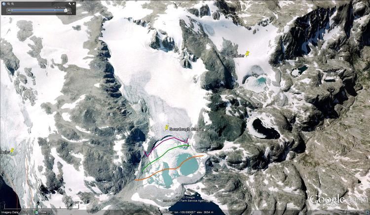
Sourdough Glacier is in the Wind River Range, Bridger-Teton National Forest in the U.S. state of Wyoming. Sourdough Glacier is in the Bridger Wilderness, and is part of the largest grouping of glaciers in the American Rocky Mountains. The glacier extends from the north slope of Klondike Peak at an elevation range of 12,800 to 11,800 ft (3,900 to 3,600 m) and flows into a proglacial lake.
Map of Sourdough Glacier, Wyoming 82925, USA
References
Sourdough Glacier Wikipedia(Text) CC BY-SA