
Country Macedonia Lowest elevation 2,000 m (7,000 ft) Postal code 2304 Area 48,013 km² Population 929 (2002) | Highest elevation 400 m (1,300 ft) Time zone CET (UTC+1) Area code(s) +389 047 Local time Monday 8:30 AM | |
 | ||
Weather 4°C, Wind NW at 3 km/h, 78% Humidity Municipality Municipality of Demir Hisar | ||
Sopotnica (Macedonian: Сoпoτница) is a village in the Republic of Macedonia, it used to be a separate municipality but as of 2005 it belongs to the Demir Hisar municipality.
Contents
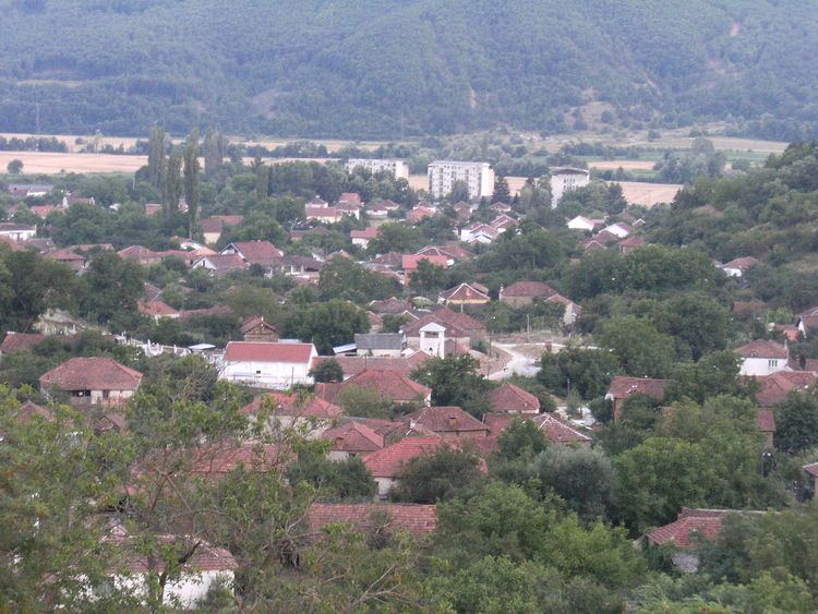
Map of Sopotnitsa, Macedonia (FYROM)
The area of Sopotnica as a typical rural and urban whole, consists of different developed small populated places-villages, starting from smaller developed villages (Boiste, Cerovo, Virovo etc.) located in the mountainous part of Sopotnica, till more developed places with elements of urban living, as is Sopotnica, the administrative centre of the former Municipality of Sopotnica. The main characteristic of the ambient of this area that will take your breath is the contrast that origins by the beauty of the wild landscapes-masterpieces of the nature, and the cultivated areas made by the anthropogenesis factors.
The area of Sopotnica is rich with real and available natural resources, huge cultural and historical heritage and other human valuables.
Demographic history
According to Vasil Kanchov's study of Macedonia in 1900, "Macedonia, Ethnography and Statistics", (Bulgarian: Македония. Етнография и статистика, Makedoniya. Etnografiya i statistika), counted the village as having 560 inhabitants, all of whom were coutned as Bulgarian Christians.
Dimitar Mišev's 1905 study of the Bulgarian Exarchate, Macedonia and its Christian population (French: La Macédoine et sa Population Chrétienne), counted 640 exarchists in the village.
Demographics Today
In the 2002 census 926 Macedonians were present in the village along with 3 Serbians. The majority of the population was elderly and the proportion of youths was below the national average.