
Country United States FIPS code 45-67435 Elevation 51 m Zip code 29593 Local time Saturday 8:12 AM | Time zone Eastern (EST) (UTC-5) GNIS feature ID 1250950 Area 5.7 km² Population 557 (2013) Area code 843 | |
 | ||
Weather 10°C, Wind N at 0 km/h, 96% Humidity | ||
Society Hill is a town in Darlington County, South Carolina, United States. It is the oldest community in Darlington County. The population was 563 at the 2010 census, down from 700 at the 2000 census. It is part of the Florence Metropolitan Statistical Area.
Contents
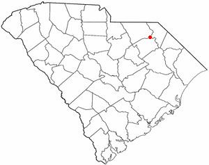
Map of Society Hill, SC 29593, USA
Society Hill was originally settled in the 18th century by a colony of Baptists, who named the community after their "St. David's Society".
Geography
Society Hill is located in northern Darlington County at 34°30′50″N 79°51′4″W (34.513827, -79.851005), on high ground rising to the west of the Pee Dee River. U.S. Routes 15 and 52 pass through the town. US 15 leads northeast 12 miles (19 km) to Bennettsville and 30 miles (48 km) to Laurinburg, North Carolina, and southwest 17 miles (27 km) to Hartsville. US 52 leads north 14 miles (23 km) to Cheraw and south 16 miles (26 km) to Darlington, the county seat. The two highways merge at the north end of town and pass through it as Main Street before diverging 0.8 miles (1.3 km) southwest of the town limits.
According to the United States Census Bureau, the town has a total area of 2.2 square miles (5.7 km2), all of it land. The Pee Dee River, which separates Darlington County from Marlboro County, is 1.4 miles (2.3 km) to the northeast of the town via US 15.
Demographics
As of the census of 2000, there were 700 people, 269 households, and 203 families residing in the town. The population density was 320.4 people per square mile (124.0/km²). There were 317 housing units at an average density of 145.1 per square mile (56.1/km²). The racial makeup of the town was 44.43% White, 54.00% African American, 0.14% Native American, 0.86% from other races, and 0.57% from two or more races. Hispanic or Latino of any race were 0.57% of the population.
There were 269 households out of which 24.5% had children under the age of 18 living with them, 52.0% were married couples living together, 19.0% had a female householder with no husband present, and 24.5% were non-families. 21.6% of all households were made up of individuals and 7.8% had someone living alone who was 65 years of age or older. The average household size was 2.60 and the average family size was 3.03.
In the town, the population was spread out with 22.0% under the age of 18, 9.6% from 18 to 24, 24.3% from 25 to 44, 29.3% from 45 to 64, and 14.9% who were 65 years of age or older. The median age was 40 years. For every 100 females, there were 89.7 males. For every 100 females age 18 and over, there were 90.9 males.
The median income for a household in the town was $30,057, and the median income for a family was $37,875. Males had a median income of $25,662 versus $18,516 for females. The per capita income for the town was $15,005. About 13.3% of families and 14.5% of the population were below the poverty line, including 26.9% of those under age 18 and 6.5% of those age 65 or over.
Notable people
The town was the birthplace of Gashouse Gang member Pat Crawford and the Oklahoma jurist Henry Marshall Furman. The Welsh Neck-Long Bluff-Society Hill Historic District was listed on the National Register of Historic Places in 1974. Japonica Hall was listed separately in 1989.