
 | ||
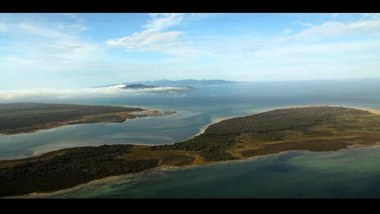
Snake Island, a 35-square-kilometre (14 sq mi) sand island, the largest island in Corner Inlet, is located in the Gippsland region of Victoria, Australia. Snake Island lies within the Nooramunga Marine and Coastal Park and is part of a complex of barrier islands that protect a large marine embayment from the pounding waves of Bass Strait.
Contents
Map of Snake Island, Victoria, Australia
As the island is remote and relatively unspoilt it is popular for bushwalkers and many tracks criss cross the island. Care must be taken on the oceanic beaches as they have rapidly changing tides. A diverse range of flora and fauna makes the island particularly interesting for naturalists.
HistoryEdit
Snake Island is part of the traditional territory of the Brataualung clan of the Gunai people, who named it "Negima". As well as being a place of refuge, it was used as a nuptial island for young couples. Since the 1880s the island has been used by South Gippsland farmers to agist cattle in winter, swimming their stock over a narrow channel at low tide.
Flora and faunaEdit
The vegetation communities of Snake Island include woodland, scrubland, heath, freshwater swamps, mangroves and salt marsh.
Mammals found on the island include the native eastern grey kangaroo, swamp wallaby, koala and swamp antechinus, as well as the introduced hog deer. There are many birds present, including the eastern ground parrot. Large numbers of migratory waders roost along the coast after feeding on the inlet's extensive intertidal mudflats.