
Area code(s) 262 Elevation 324 m | Time zone Central (CST) (UTC-6) FIPS code 55-74400 Population 5,141 (2013) | |
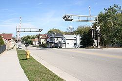 | ||
Weather 6°C, Wind S at 23 km/h, 69% Humidity Points of interest Little Switzerland, Slinger Community Park, Slinger Fireman's Park Upper | ||
Halloween 2010 in slinger wisconsin usa dr shots long version
Slinger is a village in Washington County, Wisconsin, United States. The population was 5,068 at the 2010 census.
Contents
- Halloween 2010 in slinger wisconsin usa dr shots long version
- Map of Slinger WI USA
- History
- Geography
- 2010 census
- 2000 census
- Recreation
- Education
- References
Map of Slinger, WI, USA
History
Originally named Schleisingerville after the founder, state senator Baruch Schleisinger Weil in 1857; it was renamed on December 22, 1921. The present name is after the local Slinger family.
Geography
Slinger is located at 43°19′42″N 88°17′0″W (43.328466, -88.283461).
According to the United States Census Bureau, the village has a total area of 5.31 square miles (13.75 km2), of which, 5.29 square miles (13.70 km2) of it is land and 0.02 square miles (0.05 km2) is water.
2010 census
As of the census of 2010, there were 5,068 people, 2,029 households, and 1,390 families residing in the village. The population density was 958.0 inhabitants per square mile (369.9/km2). There were 2,182 housing units at an average density of 412.5 per square mile (159.3/km2). The racial makeup of the village was 97.2% White, 0.5% African American, 0.2% Native American, 0.6% Asian, 0.3% from other races, and 1.1% from two or more races. Hispanic or Latino of any race were 2.3% of the population.
There were 2,029 households of which 36.1% had children under the age of 18 living with them, 52.7% were married couples living together, 11.0% had a female householder with no husband present, 4.8% had a male householder with no wife present, and 31.5% were non-families. 25.2% of all households were made up of individuals and 7.5% had someone living alone who was 65 years of age or older. The average household size was 2.48 and the average family size was 2.99.
The median age in the village was 37.2 years. 26.4% of residents were under the age of 18; 6.6% were between the ages of 18 and 24; 28.8% were from 25 to 44; 27.9% were from 45 to 64; and 10.3% were 65 years of age or older. The gender makeup of the village was 49.0% male and 51.0% female.
2000 census
As of the census of 2000, there were 3,901 people, 1,562 households, and 1,040 families residing in the village. The population density was 1,046.8 people per square mile (403.8/km²). There were 1,607 housing units at an average density of 431.2 per square mile (166.3/km²). The racial makeup of the village was 97.95% White, 0.26% African American, 0.15% Native American, 0.18% Asian, 0.05% Pacific Islander, 0.41% from other races, and 1.00% from two or more races. Hispanic or Latino of any race were 1.38% of the population.
There were 1,562 households out of which 34.7% had children under the age of 18 living with them, 51.8% were married couples living together, 10.2% had a female householder with no husband present, and 33.4% were non-families. 26.7% of all households were made up of individuals and 9.0% had someone living alone who was 65 years of age or older. The average household size was 2.46 and the average family size was 3.02.
In the village, the population was spread out with 26.8% under the age of 18, 7.4% from 18 to 24, 32.5% from 25 to 44, 21.1% from 45 to 64, and 12.2% who were 65 years of age or older. The median age was 36 years. For every 100 females there were 97.0 males. For every 100 females age 18 and over, there were 95.2 males.
The median income for a household in the village was $47,125, and the median income for a family was $55,607. Males had a median income of $40,783 versus $25,723 for females. The per capita income for the village was $21,450. About 6.0% of families and 6.4% of the population were below the poverty line, including 6.2% of those under age 18 and 10.7% of those age 65 or over.
Recreation
Education
Slinger is served by the School District of Slinger. Schools include Slinger Elementary School, St. Peter Catholic School, Allenton Elementary, Addison Elementary, Slinger Middle School, and Slinger High School.