
Elevation 230 m Local time Friday 3:12 AM | Region Ústí nad Labem Postal code 439 09 to 440 01 Area 8.4 km² | |
 | ||
Weather 6°C, Wind N at 16 km/h, 87% Humidity | ||
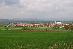
Slavětín is a small town (městys) in Louny District in the Ústí nad Labem Region of the Czech Republic.
Map of Slav%C4%9Bt%C3%ADn, Czechia
The town covers an area of 8.40 square kilometres (3.24 sq mi), and has a population of 443 (as at 31 December 2007).
Slavětín lies approximately 8 kilometres (5 mi) east of Louny, 36 km (22 mi) south of Ústí nad Labem, and 47 km (29 mi) north-west of Prague.
References
Slavětín (Louny District) Wikipedia(Text) CC BY-SA