
Total length 386 m (1,266 ft) Locale Macedonia (FYROM) | Material brick, stone Height 16.5 m (54 ft) | |
 | ||
Coordinates 42° 01′ 411″ N, 021° 25′ 124″ E Similar Ristiḱ Palace, Museum of the Macedoni, Church of St Clement of Ohrid, Millennium Cross, Holocaust Memorial Center for | ||
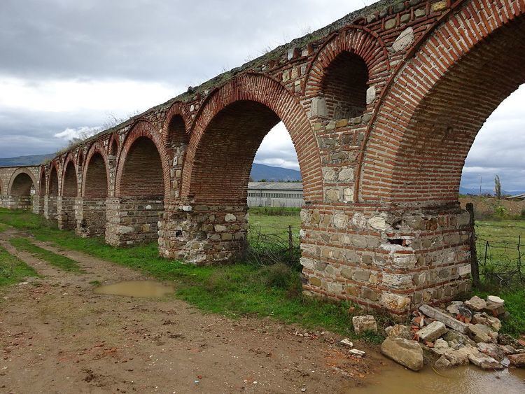
Skopje aqueduct
The Skopje Aqueduct (Macedonian: Скопски аквадукт) is an aqueduct and archaeological site located in the village of Vizbegovo 2 km (1.2 mi) northwest from Skopje, Macedonia. The Skopje Aqueduct is the only aqueduct in Macedonia, and one of three largest and well preserved in the former Yugoslavia along with Diocletianus Aqueduct near Split, Croatia and Bar Aqueduct in Montenegro.
The question of when the Skopje Aqueduct was built is unclear. There are three theories:
This aqueduct was in use until the eighteenth century. Only about 386 meters (1,266 ft) with 55 arches of this structure of stone and brick remain. It is assumed that the aqueduct took water from the spring Lavovec (village Gluvo in mountain Skopska Crna Gora), 9 kilometers (5.6 mi) northwest from Skopje and brought water to city center.