
Country Philippines Barangays Area 792 km² Province Tawi-Tawi | Founded August 26, 1959 Time zone PST (UTC+8) Local time Thursday 11:51 AM | |
 | ||
Region Autonomous Region in Muslim Mindanao (ARMM) District Lone district of Tawi-Tawi Weather 28°C, Wind E at 14 km/h, 81% Humidity | ||
Sitangkai is a second class municipality in the province of Tawi-Tawi, and it is the southernmost place of the Philippines. According to the 2015 census, it has a population of 33,334 people.
Contents
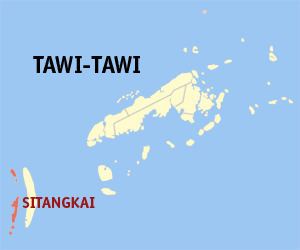
Map of Sitangkai, Tawi-Tawi, Philippines
It is called the "Venice of the Philippines" due to the use of boats as primary transportation, although footbridges connect one house from another. The major sources of livelihood are fishing and farming, although there is very sparse agricultural land available.
History
The historical Sitangkai group of islands is comprised the islands, areas, and barangays of present Sitangkai and Sibutu municipalities. The islands had been at the crossroads of the sea trade route and were a traditional enclave of the Bajau and Sama people who for centuries had peacefully lived off fishing and trading. The Kadatuan and Kasalipan (Salip/ arabic; Sharif) of Sitangkai and Sibutu were descended from the royalties of Sulu, Sabah, and Sarawak. Historical personalities such as the Datu Iskandar of Sibutu and the Datu Halon of Sitangkai was descended from the Datu Baginda Putih, Datu Baginda Hitam, and the feared Datu Kurunding of Lahat Datu from Borneo (now part of the Malaysian and Indonesian states). In the early 1900s, a man named Lailuddin ibn Jalaluddin from the area of Nunukan, Parang, Sulu was noted to be the first Tausug to settle in Sitangkai, bringing with him his clan, wealth, and slaves. Together with his sons and nephews, they settled, intermarried, and made alliances with the local traditional leaders and inhabitants. During World War II, Sitangkai and Sibutu being closer to British Malaya, was targeted by patrols and occasional raids by Japanese Imperial soldiers. Sitangkai nowadays is still a jump off port for traditional traders from Sulu, Zamboanga, mainland Tawi-tawi going to Sabah and Borneo (now part of Malaysia and Indonesia).
Present day Sitangkai was created as a municipality on August 26, 1959, by virtue of Executive Order No. 355 of President Carlos P. Garcia. On October 21, 2006, with the ratification of Muslim Mindanao Autonomy Act No. 197, 16 of its 25 barangays were transferred to the newly created municipality of Sibutu. All of which are located on Sibutu Island. Most of the residents of present day Sitangkai are settlers from Sulu, Zamboanga, and the Visayas, brought over the years and registered by subsequent competing politicians to add votes for elections. This unjust settling policy has continued unabated over the past decades, destroying the natural demographics of Sitangkai and adjoining islands, thereby affecting the natural resources of the area and disenfranchising the original peaceful Bajau and Sama inhabitants who moved to Zamboanga or Sabah, Malaysia or fled to far away pondohans (shallow sandbars). Lack of opportunities, facilities, the proliferation of illegal arms, drug addiction, and piracy are problems facing Sitangkai today.
Barangays
Sitangkai is politically subdivided into 9 barangays.