
Population 380 (2006 census) Local time Thursday 1:38 PM | Postcode(s) 7321 Postal code 7321 | |
 | ||
Location 339 km (211 mi) NW of Hobart184 km (114 mi) W of Launceston85 km (53 mi) W of Devonport25 km (16 mi) W of Wynyard Weather 19°C, Wind NE at 16 km/h, 58% Humidity | ||
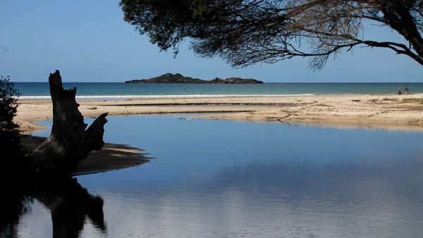
Sisters Beach is a small town located in the Waratah-Wynyard municipality of Tasmania within fifteen minutes of Wynyard, in Tasmania's North West. It is located within the Rocky Cape National Park and is situated on the old horse trail known as the Postman's Track that once formed the only connection between Emu Bay (now Burnie) and the Van Diemen's Land outpost of Stanley.
Map of Sisters Beach TAS 7321, Australia
It has a beach of white sand, approximately three kilometres in length. A unique aspect of Sisters Beach is the prevalence of giant Banksia serrata. It is the only place in Tasmania where they occur.
At the 2006 census, Sisters Beach had a population of 380. This may increase however; building new homes is currently restricted, due to the surrounding national park. It was originally established by the Irby family, descendants of whom still live in the area.