
Country Netherlands | Time zone CET (UTC+1) Local time Wednesday 8:23 PM | |
 | ||
Weather 8°C, Wind E at 11 km/h, 62% Humidity | ||
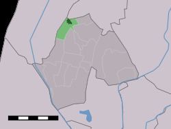
Sint Maarten (West Frisian: Simmer) is a village in the Dutch province of North Holland. It is a part of the municipality of Schagen, and lies about 15 km north of Alkmaar.
Map of Sint Maarten, Netherlands
Sint Maarten was a separate municipality until 1990, when it was merged with Harenkarspel. Harenkarspel merged with Schagen in 2013.
In 2001, the village of Sint Maarten had 796 inhabitants. The built-up area of the village was 0.20 km², and contained 315 residences. The statistical area "Sint Maarten", which also can include the peripheral parts of the village, as well as the surrounding countryside, has a population of around 940.
References
Sint Maarten, North Holland Wikipedia(Text) CC BY-SA