
Charter 1608/1865 Municipal tax rate 20.75% Local time Wednesday 6:14 AM | Time zone EET (UTC+2) | |
 | ||
Area rank 45th largest in Finland Weather 1°C, Wind SE at 18 km/h, 98% Humidity | ||
Simo is a municipality located in the province of Lapland, Finland, about 50 kilometres (30 mi) from the Swedish border.
Contents
- Map of 95200 Simo Finland
- Early History
- Development over the course of time
- Lapland War
- Landscape
- Islands within Simo
- School systems
- Industry
- Villages
- Notable individuals
- References
Map of 95200 Simo, Finland
The municipality has a population of 3,220 (31 March 2016) and covers an area of 1,447.35 square kilometres (558.82 sq mi) of which 639.89 km2 (247.06 sq mi) is water. The population density is 2.23 inhabitants per square kilometre (5.8/sq mi). In 2001, Simo's debt per capita was 946.39 Euros.
Simo's three largest neighbouring towns are Oulu (198,804 inhabitants), Kemi (21,766 inhabitants) and Tornio (22,187 inhabitants). Some of the bigger neighbouring municipalities are Keminmaa (8,383 inhabitants) and Ii (9,689 inhabitants).
Early History
The oldest residential areas of Simo are the Simonkylä and Maksniemi regions. The oldest records of human habitation within Simo is found in the village of Simonkylä, which was occupied during the 1300s. In the 1500s the population of Simo began to grow as a result of migration, the population increased especially in the villages of Simonkylä and Simoniemi. Simo was known for its large farms and fishermen.
Development over the course of time
In the 1800s the population gradually began to expand along the beaches of the Simojoki river. In the year of 1865, a large municipal reform occurred in which the municipality, named Simo, received its actual limits, even though the area had long been referred to as Simoksi and the residents simolaisiksi.
Lapland War
During the Lapland War, the village of Maksniemi suffered serious damage. Bridges along the Simojoki river were blown up by the German forces, which is why for quite some time after the war Simojoki had to be crossed by ferry. The destruction of the connection that the bridges provided was important as it cut off the municipality of Simo from Finnish Highway Four.
Landscape
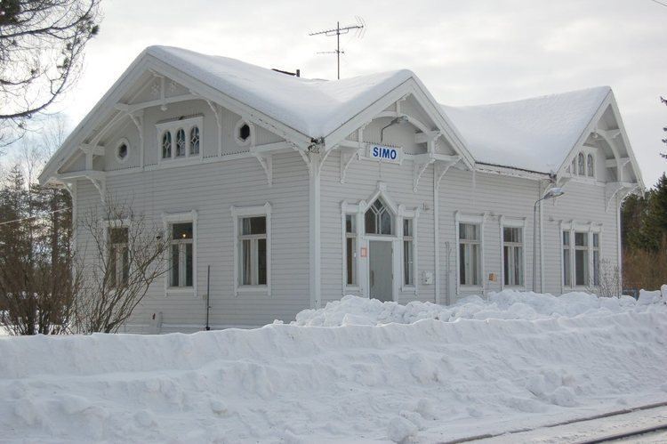
Simo is situated by the Bothnian Bay, at the mouth of river Simojoki. In Simo there is a rural landscape and also in the planning of the centre an attempt has been made to emphasise the nature vicinity. Simo consists of many small and vital village communities. Simo's sights include Simo's Church which was completed in 1846 during the late Empire time and light infantryman place with its statues which will be a memory from the war of independence when the route goes through Simo's wildernesses.
Islands within Simo
Islands within Simo are inclusive of Haahka, Halttari, Harvakari, Härkäletto, Junkiletto, Koivuluoto, Korkiakari, Kuralanletto, Laitakari, Lammasletto, Leipäre, Leipäreenkrunni, Lissabon, Louekari, Montaja, Munakari, Möyly, Oravainen, Paavonletto, Palokarinletto, Paskaletto, Pensasletot, Peurankallio, Pihlajakari, Pikku-Leipäre, Pirttisaari, Rajaletto, Saapaskari, Selkäkari, Selkäkarinmatala, Tiuranen, Tiurasenkalla, Tiurasenkrunni, Tynttyrit, Vatunki, Ykskivi and Ööperit.
School systems
Simo has three elementary schools, one secondary school and a high school. The nearest university is in Oulu.
Industry
In Simo there is no industry. In 2007–2011, Fennovoima considered to build a 1,500 to 2,500 megawatt nuclear power plant in Karsikko and Laitakari. However, Fennovoima announced in October 2011 that the power plant would be built at Pyhäjoki.
Villages
The villages of Simo are inclusive of Alaniemi, Asemakylä, Hamari, Karisuvanto, Koivuoja, Maksniemi, Malininperä, Matala, Ojalanperä, Onkalonperä, Patokoski, Pömiö, Simoniemi, Simonkylä, Siperianperä, Soikko, Taininiemi, Viantie and Ylikärppä.