
Country United States Elevation 1,132 ft (345 m) Zip code 72761 Local time Tuesday 4:20 PM | Incorporated December 22, 1881 Time zone Central (CST) (UTC-6) Population 15,856 (2013) | |
 | ||
Weather 28°C, Wind N at 6 km/h, 41% Humidity | ||
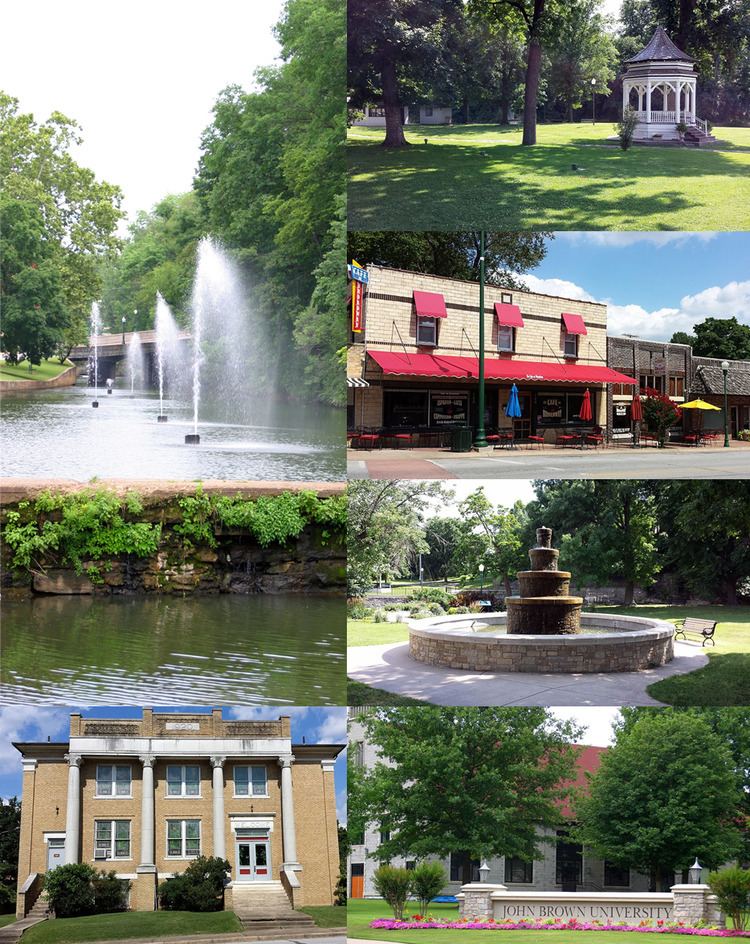
Siloam Springs is a city in Benton County, Arkansas, United States. The city shares a border on the Arkansas-Oklahoma state line with the city of West Siloam Springs, Oklahoma, which is within the Cherokee Nation territory. The town was founded in 1882 and was characterized by the purported healing powers of the spring water feeding Sager Creek and trading with nearby Native American tribes. John Brown University (JBU) was founded in 1919 as a private, interdenominational, Christian liberal arts college in the city. Today, Siloam Springs is known for its efforts to preserve and revitalize the city's historic downtown and as a promoter of the arts via Sager Creek Arts Center and the JBU art gallery. The community is located on the western edge of the growing Northwest Arkansas metropolitan area and has had a population increase of 47% to 15,039 between the 2000 and 2010 censuses.
Contents
- Map of Siloam Springs AR 72761 USA
- History
- Geography
- Metropolitan area
- Climate
- Demographics
- Government
- Education
- Transportation
- Utilities
- Notable people
- References
Map of Siloam Springs, AR 72761, USA
In 2012, the city was named one of the 20 best small towns in America by Smithsonian magazine
History
Osage Indians were the known first inhabitants of the area. Siloam Springs' first white settlers were of German and Scots-Irish origin. Simon Sager is considered the founder of the town, then known as Hico.
Geography
The area is located in the region of the country where the southern plains meet the Ozark Mountains. The city sits atop a plateau with many dogwood trees growing across the landscape. Siloam Springs is made up of Siloam Springs, Arkansas, and West Siloam Springs, Oklahoma. The latter is in the territory of the Cherokee Nation in northeastern Oklahoma.
A perennial creek, named after the founder, Sager Creek, flows through the downtown area.
According to the United States Census Bureau, the city has a total area of 11.2 square miles (28.9 km2), of which 11.1 square miles (28.7 km2) is land and 0.077 square miles (0.2 km2), or 0.71%, is water.
Metropolitan area
The Fayetteville–Springdale–Rogers Metropolitan Area consists of three Arkansas counties: Benton, Madison, and Washington, and McDonald County, Missouri. The area had a population of 347,045 at the 2000 census which had increased to 463,204 by the 2010 Census (an increase of 33.47 per cent). Siloam Springs is at the extreme western edge of this area, connected to the principal cities by Highway 412.
Climate
The climate in this area is characterized by hot, humid summers and generally mild to cool winters. According to the Köppen Climate Classification system, Siloam Springs has a humid subtropical climate, abbreviated "Cfa" on climate maps.
July is the hottest month of the year, with an average high of 89.1 °F (31.7 °C) and an average low of 68.6 °F (20.3 °C). Temperatures above 100 °F (37.8 °C) are rare but not uncommon, occurring on average twice a year. January is the coldest month with an average high of 44.3 °F (6.8 °C) and an average low of 24.2 °F (−4.3 °C). Highs below 32 °F (0.0 °C) occur on average thirteen times a year, with 2.2 nights per year dropping below 0 °F (−17.8 °C). The city's highest temperature was 111 °F (43.9 °C), recorded on July 14, 1954. The lowest temperature recorded was −24 °F (−31.1 °C), on February 12, 1899.
Precipitation is weakly seasonal, with a bimodal pattern: wet seasons in the spring and fall, and relatively drier summers and winters, but some rain in all months. The spring wet season is more pronounced than fall, with the highest rainfall in May. This differs slightly from the climate in central Arkansas, where the fall wet season is more comparable to spring.
Demographics
As of the census of 2010, there were 15,039 people in 5,138 households with 93.3% of the population in households. The racial and ethnic composition of the population was 76% non-Hispanic white, 0.8% black, 4.6% Native American, 1.6% Asian, 0.2% non-Hispanic reporting some other race, 5.0% from two or more races and 20.8% Hispanic or Latino.
At the 2000 census, there were 2,647 families residing in the city. The population density was 1,027.2 per square mile (396.4/km²). There were 4,223 housing units at an average density of 400.1 per square mile (154.4/km²). The racial makeup of the city was 85.22% White, 0.49% Black or African American, 4.29% Native American, 0.83% Asian, 0.08% Pacific Islander, 5.67% from other races, and 3.42% from two or more races. 14.00% of the population were Hispanic or Latino of any race.
There were 3,894 households out of which 34.8% had children under the age of 18 living with them, 53.8% were married couples living together, 10.6% had a female householder with no husband present, and 32.0% were non-families. 26.9% of all households were made up of individuals and 11.9% had someone living alone who was 65 years of age or older. The average household size was 2.57 and the average family size was 3.11.
In the city, the population was spread out with 26.0% under the age of 18, 16.8% from 18 to 24, 27.8% from 25 to 44, 17.1% from 45 to 64, and 12.3% who were 65 years of age or older. The median age was 30 years. For every 100 females there were 95.6 males. For every 100 females age 18 and over, there were 91.2 males.
The median income for a household in the city was $34,513, and the median income for a family was $41,153. Males had a median income of $27,339 versus $21,451 for females. The per capita income for the city was $16,047. About 9.5% of families and 12.5% of the population were below the poverty line, including 17.6% of those under age 18 and 8.6% of those age 65 or over.
As of 2009, there were 52 churches that called Siloam Springs home by address. There are reports that Siloam Springs has a record for most number churches per capita, and while the ratio is higher than average, it has never been verified through reliable documentation. (Despite the large number of churches, the town does contain a small atheist/non-religious community.) Major employers in Siloam Springs include Gates Corporation, La-Z-Boy, DaySpring (a subsidiary of Hallmark Cards), Sager Creek Vegetable Company (formally Allen's Canning), Cobb-Vantress, and John Brown University.
Government
Siloam Springs has a City Administrator form of government. The government body consists of the Mayor, Board of Directors and District Judge. All positions are chosen by election. The other officials and commissioners are appointed with Board approval.
Education
In addition to John Brown University, public education is supported by the Siloam Springs School District consisting of:
Transportation
Siloam Springs traffic is primarily served by US 412 (US 412) for east-west travel, connecting the city to Tulsa, Oklahoma, to the west via the Cherokee Turnpike and to Bentonville, Fayetteville, and Springdale, Arkansas, to the east. US 59 runs south from West Siloam Springs to Stilwell and Sallisaw, Oklahoma, while Arkansas 59 runs north to Gravette and south to Van Buren and Fort Smith, Arkansas. Within the city, major routes include Cheri Whitlock Drive, Lincoln Street, Main Street, Mount Olive Street, and University Street.
Smith Field, located east of town, serves small business jets as well as double- and single-engine aircraft. It serves exclusively general aviation operations.
Utilities
The city's primary water source is the Illinois River, although some water is purchased from Benton - Washington Regional Public Water Authority, whose source is Beaver Lake. The water is treated with chlorine, and the by-products of this chlorination process are kept compliant with the Arkansas Department of Health standards. Fluoride is added to supplement the naturally occurring amount present prior to treatment.
Wastewater is treated at the Siloam Springs Wastewater Treatment Plant (SSWWTP). Since effluent is discharged into a tributary of the Illinois, the plant's effluent is required to meet the treatment standards of both Arkansas and Oklahoma. The phosphorus load of the Illinois has been subject of controversy in the area, even reaching the United States Supreme Court in 1992. The Environmental Protection Agency (EPA) has classified the Illinois as Section 303(d) of the Clean Water Act, listing it as an "impaired and threatened water" due to the high phosphorus loads. As a result of the applicable strict phosphorus effluent regulations, SSWWTP upgraded its system in 2011. The upgrades also increased capacity 25% to 5.5 million gallons per day (MGD) (14,474 liters per hour). Although presently a traditional biological nutrient removal (BNR) plant capable of meeting the interim phosphorus limit, pilot tests have proven a chemical nutrient removal (CNR) and membrane biological reactor combination to be effective well below the possible future permit limit. However, due to the high cost, these phases have been delayed. Currently, a 3-year study is being conducted to determine the background phosphorus level in the Illinois. The future effluent limits will likely be written following the conclusion of the study. An EPA Total maximum daily load (TMDL) study in the watershed is also ongoing.
Notable people
• Jeremy Hedges (Class of 1991) - central figure in the investigation of shredded Whitewater documents at The Rose Law Firm in 1994, testified twice in front of a federal grand jury.