
Topo map USGS Strasburg Quad Prominence 607 m | Elevation 642 m Easiest route Hiking | |
 | ||
Location Shenandoah / Warren counties, Virginia, U.S. Mountain range Ridge-and-Valley Appalachians Parent range Ridge-and-Valley Appalachians Similar Big Schloss, Mary's Rock, Stony Man Mountain, Short Mountain, Old Rag Mountain | ||
Signal Knob is the northern peak of Massanutten Mountain in the Ridge and Valley Appalachians with an elevation of 2,106 feet (642 m). It is located in George Washington National Forest in Shenandoah County and Warren County in Virginia.
Map of Signal Knob, 4, VA 22652, USA
The peak offers expansive views into the northern Shenandoah Valley and the town of Strasburg, Virginia.
Signal Knob was used by Signal Corps in the American Civil War by both the Union and Confederate armies. The Confederates occupied it from 1862 to 1864, and it was a key observation point for the Battle of Cedar Creek. On August 14, 1864, a group of Union troops won control of the peak by defeating a detachment of the 61st Georgia Volunteer Infantry. Remains of Civil War era fortifications can still be seen around the area.
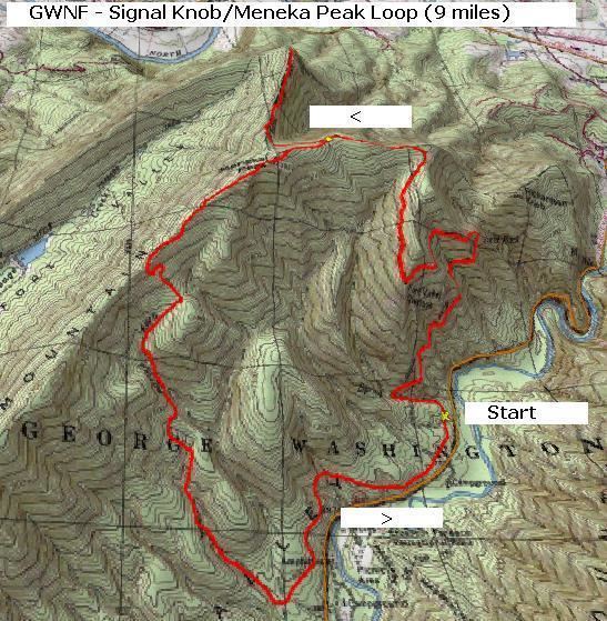
The Massanutten Trail, maintained by the Potomac Appalachian Trail Club, leads hikers and mountain bikers up to Signal Knob. There are many loop options of varying lengths which may be combined with the Tuscarora Trail. Trails in the Signal Knob area are known to be less crowded than Shenandoah National Park, to the east.