
OS grid reference SP7249 Dialling code 01604 Population 290 (2011) | Sovereign state United Kingdom Postcode district NN12 | |
 | ||
Shutlanger is a small village and civil parish in south Northamptonshire, England. The village is 5 miles (8 km) east of Towcester and 7 miles (11 km) south of Northampton.
Map of Shutlanger, Towcester, UK
In 1881 Shutlanger parish's total population was 403. In 1901 it was 339 and by 1971 it had dropped to 233. At the time of the 2001 census, it was 270 people, increasing to 290 at the 2011 census.
There was a great medieval house here called the Monastery, but it was just a house and not a monastery in the normal sense. The village is close to Stoke Park Pavilions and originally part of the Stoke Park estate with the first Palladian-style English country house.The building is a Grade I listed Building.
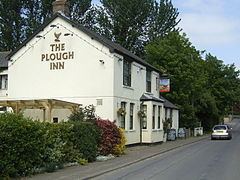
Shutlanger has its own Parish Council and belongs to the church grouping with Stoke Bruerne and Grafton Regis. The village has a pub (named The Plough) and a village hall. The nearest primary school and church are at Stoke Bruerne one mile east of Shutlanger.