
Topo map USGS Goat Peak Country United States of America | Elevation 9,678 ft (2,950 m) Highest point Mount Lewis | |
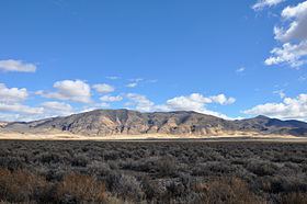 | ||
The Shoshone Range is a mountain range in Lander County, Nevada. The northeast end of the range extends into Eureka County at Shoshone Point on the Humboldt River.
Map of Shoshone Range, Nevada 89820, USA
References
Shoshone Range Wikipedia(Text) CC BY-SA