
- Tree Japanese beech Area 277 km² Local time Sunday 6:42 AM | District Kitashitara Population 5,747 (Feb 2011) | |
 | ||
Region Chūbu regionTōkai region Weather 1°C, Wind NE at 6 km/h, 97% Humidity Points of interest Ureyama, Iwakoyasan, Dandokōgen Prefectur, Kurakakeyama, Mt Myojin | ||
Shitara (設楽町, Shitara-chō) is a town located in Kitashitara District, Aichi Prefecture, Japan. As of 2010, the town had an estimated population of 5,747 and a population density of 21 persons per km². The total area was 273.96 km².
Contents
- Map of Shitara Kitashitara District Aichi Prefecture Japan
- Geography
- Neighboring municipalities
- History
- Economy
- Primary schools
- Junior High schools
- High schools
- Foreign Exchange Program
- Railway
- Highway
- Local attractions
- Noted people from Shitara
- References
Map of Shitara, Kitashitara District, Aichi Prefecture, Japan
Geography
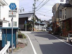
Shitara is located in the extreme northeast corner of Aichi Prefecture. Much of the town’s area is covered by mountains and forest, and portions of the town are within the borders of the Tenryū-Okumikawa Quasi-National Park.
Neighboring municipalities
Aichi Prefecture
Nagano Prefecture
History
During the Edo period most of present Shitara was tenryō under direct control of the Tokugawa shogunate. After the Meiji Restoration, the area was organized into several villages within Kitashitara District. Taguchi Village, the site of the district administrative office, was elevated to town status on October 10, 1900. The town of Shitara was established on September 30, 1956 through the merger of Taguchi with the neighboring villages of Damine, Nagura and Furikusa. The village of Tsugu was also formed on the same day through the merger of Kamitsugu and Shimotsugu villages. Shitara and Tsugu merged on October 1, 2005.
Economy
The primary industry of Shitara is agriculture.
Primary schools
Junior High schools
High schools
Foreign Exchange Program
Railway
Shitara is not served by railway.