
Country Japan Prefecture Aichi Prefecture Population 47,074 (May 2015) | Region Chūbu (Tōkai) Phone number 0536-23-1111 Local time Sunday 2:21 AM | |
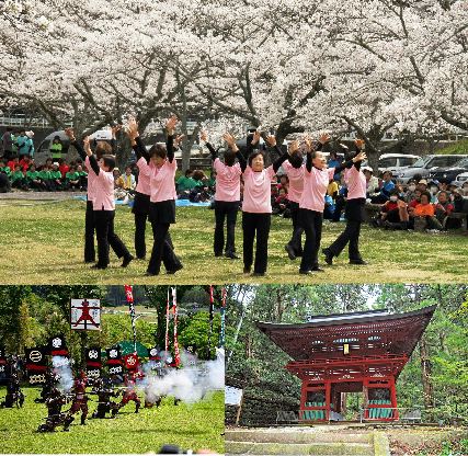 | ||
Time zone Japan Standard Time (UTC+9) Address 6-1 Higashi-Iribune, Shinshiro-shi, Aichi-ken 441-1392 Weather 4°C, Wind NE at 6 km/h, 92% Humidity Points of interest Shinjo Total Park, Hōrai‑ji Temple, Sakurabuchi Park, Hōraisan Tōshō‑gū, Nagashino Castle | ||
Shinshiro (新城市, Shinshiro-shi) is a city located in Aichi Prefecture, Japan.
Contents
- Map of Shinshiro Aichi Prefecture Japan
- Geography
- Neighboring municipalities
- History
- Economy
- Education
- Rail
- Highway
- Sister city relations
- Local attractions
- Notable people from Shinshiro
- References
Map of Shinshiro, Aichi Prefecture, Japan
As of May 2015, the city had an estimated population of 47,074 and a population density of 94.3 persons per km2. The total area was 499.23 square kilometres (192.75 sq mi).
Geography
Shinshiro is located in east-central Aichi Prefecture. Much of the northern and eastern portion of the city area is covered in mountains and forest, and most was within the borders of the Aichi Kōgen Quasi-National Park
Neighboring municipalities
History
The area of present-day Shinshiro was part of the territories of the Okudaira clan, the predecessors of the Matsudaira clan and Tokugawa clan during the Sengoku period. Their stronghold, Nagashino Castle in what is now the northern part of Shinshiro, was the site of the Battle of Nagashino, between the forces of Oda Nobunaga and the Takeda clan. Noda Castle, at which Takeda Shingen was wounded at the Siege of Noda was also located within the borders of Shinshiro. During the Edo period, most of the area was tenryō territory ruled directly by the Tokugawa shogunate through hatamoto administrators.
After the start of the Meiji period, Shinshiro Town in Minamishitara District, Aichi Prefecture was proclaimed on October 1, 1889. The area of the town expanded through annexation of neighboring villages in 1955 and 1956. The city of Shinshiro was proclaimed on November 1, 1958.
On October 1, 2005, the town of Hōrai, and the village of Tsukude (both from Minamishitara District) were merged into Shinshiro. The city of Shinshiro now covers all of former Minamishitara District.
Economy
Shinshiro is a regional commercial center, with the economy of concentrated on agriculture and light manufacturing.