
Population 875 (2011) Civil parish Shilton | OS grid reference SP405844 Sovereign state United Kingdom Local time Saturday 2:48 PM Dialling code 024 | |
 | ||
Weather 13°C, Wind W at 16 km/h, 64% Humidity | ||
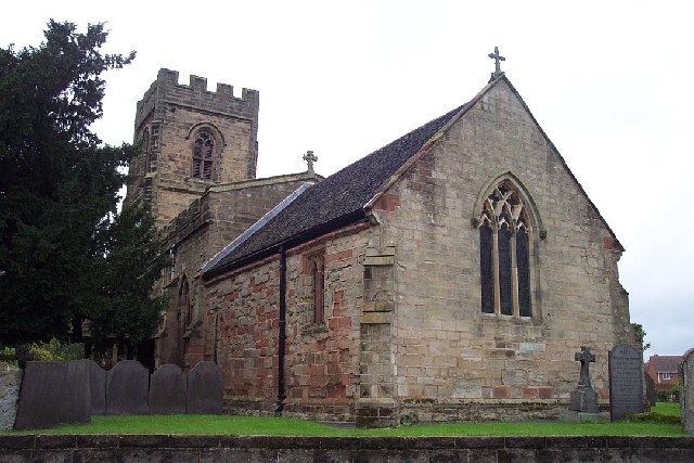
Shilton is a village and civil parish in the English county of Warwickshire. The parish of Shilton also includes the nearby hamlet of Barnacle, and in the 2001 census had a population of 826, increasing to 875 at the 2011 Census.
Map of Shilton, UK
The village is about 2 miles (3.2 km) north-east of Coventry on the B4065 road and at a crossroads with the B4029 road. Administratively, Shilton is in an outlying part of the borough of Rugby, although it is more than ten miles (16 km) from the town of Rugby.
Shilton is almost cut in two by the London to Manchester railway line (West Coast Main Line). It formerly had a railway station but this closed in 1957.
The village contains a number of old cottages along the main street,a village hall and one old pub, the "Shilton Arms".
Leicester Road is just past the Shilton arms. Leicester Road contains a farm which field lies next to the Shilton Arms garden. As you enter Leicester Road on the left hand side there is a white house which used to be a pub too but was converted into a house in 2002.