
Congressional district At-large Website www.co.sheridan.mt.us Founded 1913 | Area 4,418 km² Population 3,668 (2013) Unemployment rate 2.0% (Apr 2015) | |
 | ||
Rivers Whitetail Creek, Willow Creek, Muddy Creek | ||
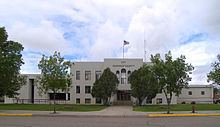
Sheridan County is a county located in the U.S. state of Montana. As of the 2010 census, the population was 3,384. Its county seat is Plentywood. Sheridan County was established in 1913 when the Montana Legislature split Dawson and Valley Counties. It was named after American Civil War General Philip Sheridan. Its northern boundary is the Canada–United States border south of Saskatchewan.
Contents
- Map of Sheridan County MT USA
- Geography
- Major highways
- Adjacent counties and rural municipalities
- National protected area
- 2000 census
- 2010 census
- City
- Towns
- Census designated places
- Unincorporated communities
- Ghost towns
- References
Map of Sheridan County, MT, USA
Geography
According to the U.S. Census Bureau, the county has a total area of 1,706 square miles (4,420 km2), of which 1,677 square miles (4,340 km2) is land and 29 square miles (75 km2) (1.7%) is water.
Major highways
Adjacent counties and rural municipalities
National protected area
2000 census
As of the census of 2000, there were 4,105 people, 1,741 households, and 1,140 families residing in the county. The population density was 2.4 people per square mile (0.9/km²). There were 2,167 housing units at an average density of 1.3 per square mile (0.5/km²). The racial makeup of the county was 97.00% White, 0.10% Black or African American, 1.22% Native American, 0.29% Asian, 0.02% Pacific Islander, 0.19% from other races, and 1.17% from two or more races. 1.07% of the population were Hispanic or Latino of any race. 35.5% were of Norwegian, 19.0% German and 8.9% Danish ancestry.
There were 1,741 households out of which 27.00% had children under the age of 18 living with them, 57.50% were married couples living together, 4.80% had a female householder with no husband present, and 34.50% were non-families. 32.30% of all households were made up of individuals and 16.60% had someone living alone who was 65 years of age or older. The average household size was 2.29 and the average family size was 2.87.
In the county, the population was spread out with 22.90% under the age of 18, 4.80% from 18 to 24, 22.20% from 25 to 44, 26.50% from 45 to 64, and 23.60% who were 65 years of age or older. The median age was 45 years. For every 100 females there were 98.70 males. For every 100 females age 18 and over, there were 96.80 males.
The median income for a household in the county was $29,518, and the median income for a family was $35,345. Males had a median income of $23,053 versus $20,112 for females. The per capita income for the county was $16,038. About 10.60% of families and 14.70% of the population were below the poverty line, including 16.40% of those under age 18 and 15.80% of those age 65 or over.
2010 census
As of the 2010 United States Census, there were 3,384 people, 1,587 households, and 944 families residing in the county. The population density was 2.0 inhabitants per square mile (0.77/km2). There were 2,089 housing units at an average density of 1.2 per square mile (0.46/km2). The racial makeup of the county was 95.4% white, 1.7% American Indian, 0.4% Asian, 0.2% black or African American, 0.3% from other races, and 2.0% from two or more races. Those of Hispanic or Latino origin made up 1.5% of the population. In terms of ancestry, 33.8% were Norwegian, 26.0% were German, 12.0% were Danish, 11.6% were Irish, 5.5% were Swedish, 5.3% were English, and 5.0% were American.
Of the 1,587 households, 21.3% had children under the age of 18 living with them, 49.5% were married couples living together, 5.7% had a female householder with no husband present, 40.5% were non-families, and 37.1% of all households were made up of individuals. The average household size was 2.08 and the average family size was 2.70. The median age was 50.3 years.
The median income for a household in the county was $39,578 and the median income for a family was $55,313. Males had a median income of $46,932 versus $22,107 for females. The per capita income for the county was $26,537. About 6.4% of families and 14.5% of the population were below the poverty line, including 8.8% of those under age 18 and 10.4% of those age 65 or over.