
Country United States FIPS code 30-67600 Elevation 1,559 m Zip code 59749 Local time Saturday 2:25 AM | Time zone Mountain (MST) (UTC-7) GNIS feature ID 0776478 Area 2.64 km² Population 650 (2013) Area code 406 | |
 | ||
Weather 1°C, Wind S at 3 km/h, 78% Humidity | ||
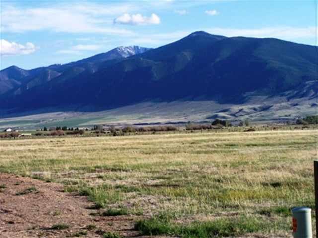
Above sheridan montana
Sheridan is a town in Madison County, Montana, United States named after the Civil War general Philip Sheridan. The population was 642 at the 2010 census. Sheridan is known as the "heart of the Ruby Valley." Seven majestic mountain ranges surround this beautiful community. (Tobacco Root Range, Highlands Mountains, McCartney Mountain, The Pioneers, The Ruby Range, The Gravellies and the Snowcrest Range) The geology of the area includes some of the oldest rocks dating back over 2.7 billion years. The Ruby River winds through the valley just west of the town.
Contents
- Above sheridan montana
- Map of Sheridan MT 59749 USA
- Sheridan montana parade
- Geography
- Climate
- 2010 census
- 2000 census
- References
Map of Sheridan, MT 59749, USA
In an effort to promote the town - the community has formed a Main Street Improvement Team, provides for free Wi-Fi in town and has their own Web site where artists, businesses, and general information about the area can be found at their home page [1]
Sheridan montana parade
Geography
Sheridan is located at 45°27′22″N 112°11′45″W (45.456173, -112.195793).
According to the United States Census Bureau, the town has a total area of 1.02 square miles (2.64 km2), all of it land.
Climate
According to the Köppen Climate Classification system, Sheridan has a semi-arid climate, abbreviated "BSk" on climate maps.
2010 census
As of the census of 2010, there were 642 people, 306 households, and 174 families residing in the town. The population density was 629.4 inhabitants per square mile (243.0/km2). There were 376 housing units at an average density of 368.6 per square mile (142.3/km2). The racial makeup of the town was 95.3% White, 0.3% African American, 0.5% Native American, 0.5% Asian, 0.5% from other races, and 3.0% from two or more races. Hispanic or Latino of any race were 1.1% of the population.
There were 306 households of which 23.2% had children under the age of 18 living with them, 45.1% were married couples living together, 8.8% had a female householder with no husband present, 2.9% had a male householder with no wife present, and 43.1% were non-families. 40.2% of all households were made up of individuals and 20.9% had someone living alone who was 65 years of age or older. The average household size was 1.99 and the average family size was 2.66.
The median age in the town was 53.1 years. 19.2% of residents were under the age of 18; 2.6% were between the ages of 18 and 24; 17.3% were from 25 to 44; 32% were from 45 to 64; and 29% were 65 years of age or older. The gender makeup of the town was 45.3% male and 54.7% female.
2000 census
As of the census of 2000, there were 659 people, 302 households, and 170 families residing in the town. The population density was 643.4 people per square mile (249.5/km²). There were 365 housing units at an average density of 356.3 per square mile (138.2/km²). The racial makeup of the town was 95.14% White, 0.15% African American, 1.06% Native American, 1.67% from other races, and 1.97% from two or more races. Hispanic or Latino of any race were 1.67% of the population.
There were 302 households out of which 22.8% had children under the age of 18 living with them, 49.0% were married couples living together, 5.3% had a female householder with no husband present, and 43.7% were non-families. 39.4% of all households were made up of individuals and 24.8% had someone living alone who was 65 years of age or older. The average household size was 2.07 and the average family size was 2.78.
In the town, the population was spread out with 20.5% under the age of 18, 3.8% from 18 to 24, 20.5% from 25 to 44, 26.4% from 45 to 64, and 28.8% who were 65 years of age or older. The median age was 48 years. For every 100 females there were 85.6 males. For every 100 females age 18 and over, there were 77.0 males.
The median income for a household in the town was $21,118, and the median income for a family was $26,563. Males had a median income of $27,639 versus $15,000 for females. The per capita income for the town was $15,369. About 22.0% of families and 25.1% of the population were below the poverty line, including 43.2% of those under age 18 and 13.1% of those age 65 or over.