
OS grid reference SH552265 Country Wales Postcode district LL45 Dialling code 01341 Post town Llanbedr railway station | Principal area Gwynedd Sovereign state United Kingdom Police North Wales Ceremonial county Gwynedd | |
 | ||
Similar Rhinogydd, Harlech Castle, Llanbedr railway station, Royal St David's Golf Club, Rhinog Fawr | ||
Shell island wales 2016
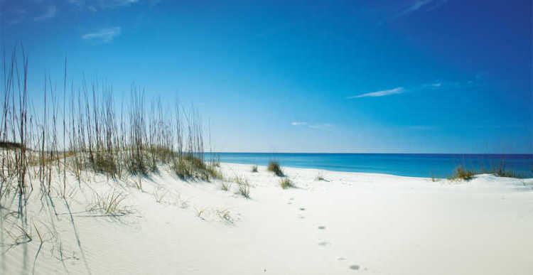
Shell Island, also known as Mochras, is a peninsula lying west of Llanbedr in Gwynedd, Wales. It was formed after the River Artro was diverted by the Earl of Winchelsey in 1819 from its previous course where it entered the sea to the south of Shell Island. Prior to this, access to the ancient settlement on the island would have been through the village of Llandanwg, which is now across the estuary.
Contents
Shell Island is known for the wide variety of seashells that wash up on the beach, and for its wild flowers. It is said to have been connected to the mythical Cantre'r Gwaelod.
Public vehicular access to the island is only possible via a causeway across the estuary of the River Artro when the tide is out. Access on foot is always possible from the adjacent Mochras/Morfa Dyffryn beach, which extends for several kilometres south of Shell Island. Access to emergency vehicles is available at any time through the neighbouring airfield.
Shell Island has a popular camp site which offers the opportunity to practise "wild camping" in pitches which are far from the nearest neighbour (and from toilet and other facilities). Camp fires are allowed on the beach; on the campsite only raised contained fires and barbecues are allowed.
The island lies within the Snowdonia National Park, as a result of which the campsite closes from the end of October to the following March. During this period local farmers bring their sheep from the lowlands to graze on the island.
Geology
Mochras is significant for the UK Earth Sciences. The area consists of a low lying raised beach (which encompasses the nearby Llanbedr Airport) and it caused a sensation (in the geological community, at least), when the British Geological Survey (then known as the Institute of Geological Sciences) drilled a 1938 m deep stratigraphic proving borehole at Mochras Farm between late 1967 and late 1969. Beneath the obscuring recent beach cover, the Mochras Borehole found relatively young Tertiary and Mesozoic rocks (including a well-developed Upper, Middle and Lower Lias section towards the base of the Jurassic), faulted against the ancient Cambrian rocks of the Harlech dome. In 1971, the vertical throw of the fault was judged to be at least 4500 m.