
 | ||
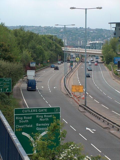
The Sheffield Parkway is a major dual carriageway which runs between the City of Sheffield and junction 33 of the M1 in South Yorkshire, England. The 5.5-mile (8.9 km) road was opened in 1974, and runs to the east of the City, connecting Park Square in the City centre with the inner ring road, outer ring road and out to the M1 motorway at junction 33. On this route it passes the districts of Wybourn, Darnall, Handsworth, and the village of Catcliffe, at which a slip road connects to the now defunct Sheffield City Airport, Sheffield Business Park and the Advanced Manufacturing Park (AMP). Many businesses and Sheffield attractions are located close to the Parkway as it is known in Sheffield, and it can become highly congested. For approximately 2.5 miles (4.0 km) of its route the road forms a part of the A57 road, the rest being part of the A630 road.