
Country Japan - Flower Japanese iris Population 105,360 (Nov 2011) Phone number 052-731-1511 | - Tree Flowering Dogwood Area 10.94 km² Prefecture Aichi Prefecture | |
 | ||
Region Tōkai region
Chūbu region Time zone Japan Standard Time (UTC+9) Website www.city.nagoya.jp/showa/ (Japanese) Address 3-19, Yuwa-dori, Showa-ku, Nagoya-shi, Aichi-ken 466-8585 | ||
Shōwa-ku (昭和区, Shōwa-ku) is one of the 16 wards of the city of Nagoya in Aichi Prefecture, Japan. As of 2011, the ward had an estimated population of 105,360 and a population density of 9,630 persons per km². The total area was 10.94 km².
Contents
- Map of Showa Ward Nagoya Aichi Prefecture Japan
- Geography
- Surrounding municipalities
- History
- Education
- Railroads
- Highways
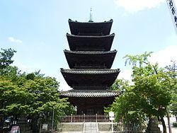
- Local attractions
- Noted people from Shwa Ward Nagoya
- References
Map of Showa Ward, Nagoya, Aichi Prefecture, Japan
Geography
Shōwa Ward is located near the geographic center of Nagoya.
Surrounding municipalities
History
Gokiso Village in Aichi District was annexed by Nagoya on August 22, 1921, becoming part of Naka District. Shōwa District was established on October 1, 1937 out of a portion of former Naka District and Minami District. On Feb 11, 1944, a portion of Shōwa District joined with a portion of Atsuta District to form Mizuho District. On April 5, 1955 the district annexed neighboring Tempaku village, which became the separate Tempaku District on February 1, 1977.