
Founded 1867 Population 17,089 (2013) | Congressional district 1st Area 1,492 km² | |
 | ||
Website www.connectseward.org/cgov Cities Seward, Milford, Beaver Crossing, Utica, Pleasant Dale, Goehner, Staplehurst, Garland, Bee, Tamora, Nebraska, Cordova Colleges and Universities Concordia University (Nebraska), Southeast Community College Points of interest Nebraska National Guard Mu, World's Largest Time Cap, Smith Creek Recreatio, Seward County Historical | ||
Hunting seward county nebraska
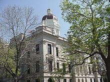
Seward County is a county located in the U.S. state of Nebraska. As of the 2010 census, the population was 16,750. Its county seat is Seward. The county was formed in 1855 and later organized in 1867. It was originally called Greene County, and in 1862 it was renamed in honor of William H. Seward, United States Secretary of State under Abraham Lincoln and Andrew Johnson. Seward County is part of the Lincoln, NE Metropolitan Statistical Area.
Contents
- Hunting seward county nebraska
- Map of Seward County NE USA
- Geography
- Major highways
- Adjacent counties
- Demographics
- Cities
- Census designated place
- Unincorporated communities
- Ghost town
- References
Map of Seward County, NE, USA
In the Nebraska license plate system, Seward County is represented by the prefix 16 (it had the sixteenth-largest number of vehicles registered in the county when the license plate system was established in 1922).
Geography
According to the U.S. Census Bureau, the county has a total area of 576 square miles (1,490 km2), of which 571 square miles (1,480 km2) is land and 4.5 square miles (12 km2) (0.8%) is water.
Major highways
Adjacent counties
Demographics
As of the census of 2000, there were 16,496 people, 6,013 households, and 4,215 families residing in the county. The population density was 29 people per square mile (11/km²). There were 6,428 housing units at an average density of 11 per square mile (4/km²). The racial makeup of the county was 98.05% White, 0.28% Black or African American, 0.21% Native American, 0.29% Asian, 0.05% Pacific Islander, 0.40% from other races, and 0.72% from two or more races. 1.09% of the population were Hispanic or Latino of any race.
There were 6,013 households out of which 32.80% had children under the age of 18 living with them, 61.50% were married couples living together, 5.60% had a female householder with no husband present, and 29.90% were non-families. 24.90% of all households were made up of individuals and 12.10% had someone living alone who was 65 years of age or older. The average household size was 2.53 and the average family size was 3.04.
In the county, the population was spread out with 24.70% under the age of 18, 14.30% from 18 to 24, 24.60% from 25 to 44, 21.20% from 45 to 64, and 15.20% who were 65 years of age or older. The median age was 36 years. For every 100 females there were 103.20 males. For every 100 females age 18 and over, there were 102.50 males.
The median income for a household in the county was $42,700, and the median income for a family was $51,813. Males had a median income of $32,218 versus $22,329 for females. The per capita income for the county was $18,379. About 4.10% of families and 7.00% of the population were below the poverty line, including 6.20% of those under age 18 and 6.80% of those age 65 or over.