
District Rotenburg (Wümme) Elevation 27 m (89 ft) Area 41.86 km² Postal code 27446 Dialling code 04284 | Municipal assoc. Selsingen Time zone CET/CEST (UTC+1/+2) Population 3,415 (31 Dec 2008) Local time Monday 3:50 AM | |
 | ||
Weather 3°C, Wind NE at 6 km/h, 91% Humidity | ||
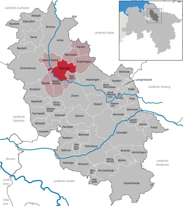
Selsingen is a municipality in the district of Rotenburg, in Lower Saxony, Germany. It is situated approximately 15 kilometres (9.3 mi) southeast of Bremervörde, and 45 kilometres (28 mi) northeast of Bremen, and is twinned with the English village of Sawston in Cambridgeshire.
Map of 27446 Selsingen, Germany
Selsingen belonged - as to its government - to the Prince-Archbishopric of Bremen, established in 1180. In religious respect, however, Selsingen formed part of the Roman Catholic Diocese of Verden until after 1566 its incumbent bishops lost papal recognition, except of a last Catholic bishop from 1630 to 1631, respectively. In 1648 the Prince-Archbishopric was transformed into the Duchy of Bremen, which was first ruled in personal union by the Swedish and from 1715 on by the Hanoverian Crown. In 1823 the Duchy was abolished and its territory became part of the Stade Region.
Selsingen is also the seat of the Samtgemeinde ("collective municipality") Selsingen.