
Location Sachsen Country Germany | River system Elbe | |
 | ||
Main source Source: near Neudorf
ca. 720 m above sea level (NHN) River mouth near Wiesa into the Zschopau
464.5 m above sea level (NHN) Progression Zschopau → Mulde → Elbe → North Sea | ||
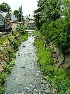
The Sehma is a right tributary of the river Zschopau in the German federal state of Saxony and begins at the confluence of its headstreams the White Sehma (Weiße Sehma) and Red Sehma (Rote Sehma).
Map of Sehma, Germany
In the valley of the combined Sehma are the long, narrow villages of Neudorf, Cranzahl and Sehma which belong to the municipality of Sehmatal. The Sehma continues to the merged town of Annaberg-Buchholz where it divides Buchholz in the west from Annaberg in the east, the two quarters having been independent towns until 1945. The Sehma valley is also home to the village of Frohnau and its well-known hammer mill, the Frohnauer Hammer. Above Wiesa the Sehma discharges into the Zschopau.
References
Sehma Wikipedia(Text) CC BY-SA