OS grid reference NS756748 Sovereign state United Kingdom Postcode district G67 Dialling code 01236 | Post town GLASGOW | |
 | ||
UK parliament constituency Cumbernauld, Kilsyth and Kirkintilloch East Lieutenancy areas | ||
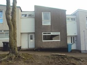
Seafar is an area of the town of Cumbernauld.
Map of Seafar, Cumbernauld, Glasgow, UK
Seafar is south of the M80 motorway (formerly the A80 trunk road) and is bordered by Seafar wood, planted at the time of the construction of the town. The area was the second built in the new town of Cumbernauld, its many streets are named after famous Scottish sports heroes, and writers. It has two local primary schools, St Mary's and Ravenswood Primary.
Added to that, there is a Kingdom Hall of Jehovah's Witnesses next to St Mary's Primary school and up the hill from one of Cumbernauld's five high schools, Our Lady's High school.
References
Seafar Wikipedia(Text) CC BY-SA
