
Country United States County Mason Time zone Eastern (EST) (UTC-5) Zip code 49454 Local time Saturday 3:55 AM | Elevation 692 ft (211 m) Area code(s) 231 Population 1,214 (2013) | |
 | ||
Weather 3°C, Wind NE at 10 km/h, 95% Humidity University | ||
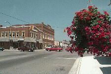
Scottville is a city located in the north west of the U.S. state of Michigan in rural Mason County. The population was 1,214 at the 2010 census.
Contents
- Map of Scottville MI 49454 USA
- Geography
- 2010 census
- 2000 census
- Scottville Clown Band
- Education
- References
Map of Scottville, MI 49454, USA
Scottville was named for Hiram Scott in a coin toss.
On July 23, 2007 Governor Jennifer Granholm announced Scottville as the community chosen by the Michigan State Housing Development Authority (MSHDA) to take part in the Cool Cities Michigan Main Street program. Scottville will receive five years of intensive technical assistance through MSHDA, to help create opportunities for new development, economic growth and jobs. [1] A similar award, the Blueprints for Downtowns award, were announced to be received by the communities of Caro, Clio and Ypsilanti.
Geography
According to the United States Census Bureau, the city has a total area of 1.49 square miles (3.86 km2), all land. The city of Scottville itself is approximately 10 miles east of the city of Ludington and Lake Michigan, five miles west of the village of Custer and 10 miles south west of the village of Fountain.
2010 census
As of the census of 2010, there were 1,214 people, 483 households, and 309 families residing in the city. The population density was 814.8 inhabitants per square mile (314.6/km2). There were 578 housing units at an average density of 387.9 per square mile (149.8/km2). The racial makeup of the city was 92.9% White, 0.9% African American, 0.9% Native American, 0.5% Asian, 2.0% from other races, and 2.8% from two or more races. Hispanic or Latino of any race were 5.3% of the population.
There were 483 households of which 34.8% had children under the age of 18 living with them, 38.9% were married couples living together, 19.7% had a female householder with no husband present, 5.4% had a male householder with no wife present, and 36.0% were non-families. 32.3% of all households were made up of individuals and 11.2% had someone living alone who was 65 years of age or older. The average household size was 2.51 and the average family size was 3.09.
The median age in the city was 35.1 years. 28.2% of residents were under the age of 18; 8.9% were between the ages of 18 and 24; 25% were from 25 to 44; 24.3% were from 45 to 64; and 13.8% were 65 years of age or older. The gender makeup of the city was 47.9% male and 52.1% female.
2000 census
As of the census of 2000, there were 1,266 people, 525 households, and 345 families residing in the city. The population density was 866.5 per square mile (334.8/km²). There were 574 housing units at an average density of 392.9 per square mile (151.8/km²). The racial makeup of the city was 94.47% White, 0.63% African American, 0.87% Native American, 0.16% Asian, 1.26% from other races, and 2.61% from two or more races. Hispanic or Latino of any race were 4.82% of the population.
There were 525 households out of which 33.7% had children under the age of 18 living with them, 43.6% were married couples living together, 17.5% had a female householder with no husband present, and 34.1% were non-families. 31.0% of all households were made up of individuals and 13.7% had someone living alone who was 65 years of age or older. The average household size was 2.40 and the average family size was 2.97.
In the city, the population was spread out with 27.3% under the age of 18, 10.2% from 18 to 24, 25.2% from 25 to 44, 20.9% from 45 to 64, and 16.4% who were 65 years of age or older. The median age was 36 years. For every 100 females there were 86.7 males. For every 100 females age 18 and over, there were 80.9 males.
The median income for a household in the city was $27,750, and the median income for a family was $36,875. Males had a median income of $26,583 versus $22,917 for females. The per capita income for the city was $15,703. About 15.5% of families and 18.4% of the population were below the poverty line, including 32.8% of those under age 18 and 1.9% of those age 65 or over.
Scottville Clown Band
Scottville is the home of the Scottville Clown Band which performs at over 60 parades and concerts each year all throughout the Midwest.
The Scottville Clown Band's origin dates back to 1903 when a group of local merchants dressed in costume and performed for local festivals. At that time the group dressed as hillbillies. In the 1920s, the group became known as the Scottsville Lady's Band and the (male) members dressed in drag. This group lasted until the outbreak of World War II, when many of the band's key members joined the service.
In 1947, Ray Schulte, owner of Scottville men's clothing store Schulte & Thompson, re-formed the band as the Scottville Clown Band. They made their debut at the 1947 Scottville Harvest Festival. They also played for the Ludington Fourth of July parade in 1948.
Word spread about the band and it soon was performing outside the Scottville-Ludington areas, including the Grand Haven Coast Guard Festival. The band has played every Coast Guard Festival parade since 1950.
Today, the Scottville Clown Band is a non-profit corporation with over 300 members. It performs over 60 times a year for parades, concerts, entertainment tents and private celebrations. Profits from performances and merchandise sales help maintain the band's extensive music collection and its coach. The band also maintains the Raymond Schulte Memorial Scholarship Program, which provides thousands of dollars a year to children going to music camps.
Education
Scottville is home to West Shore Community College, a two-year college established in 1967.