
Isolation 9.7 km → Zuckerhütl First ascent 1840 Parent range Stubai Alps | Elevation 3,497 m Prominence 523 m Mountain range Alps, Stubai Alps | |
 | ||
Normal route Gries – Amberger Hut – Hohes Egg - Schrankogel Similar Ruderhofspitze, Schrandele, Wilde Leck, Zuckerhütl, Ramolkogel | ||
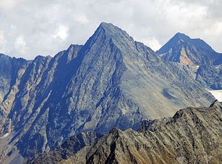
The Schrankogel, 3497 m (called the Schrankogl on the AV map) is the second highest mountain in the Stubai Alps. The northeast side of the Schrankogel is steep and snowy; from all other sides the Schrankogel has a rocky character.
Map of Schrankogel, 6444, Austria
References
Schrankogel Wikipedia(Text) CC BY-SA