
Area less than one acre Architectural style Long Truss Added to NRHP 4 June 1981 | Built 1889 NRHP Reference # 81000602 Opened 1889 | |
 | ||
Architect Quincy,J. Grim; Cunningham,R.B. Similar Staats Mill Covered Bridge, Fish Creek Covered Bridge, Simpson Creek Covered, Fletcher Covered Bridge, Dents Run Covered Bridge | ||
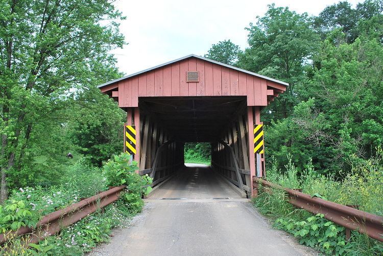
Sarvis Fork Covered Bridge, also known as Sandyville Covered Bridge, is a historic covered bridge located near Sandyville, Jackson County, West Virginia. It was built in 1889-1890 for $64.00 by R. B. Cunningham and G.W. Staats, originally spanning John Carnahan's Fork, a branch of Mill Creek. When State Route 33 was built using an iron bridge the covered bridge was first abandoned then moved and rebuilt over the left fork of the Sandy River for $1,050.00. The bridge was completely rebuilt in 2000. It measures 101 feet, 3 1/2 inches, in length and 11 feet, 8 inches wide.
It was listed on the National Register of Historic Places in 1981.
References
Sarvis Fork Covered Bridge Wikipedia(Text) CC BY-SA