
Time zone EET (UTC+2) Elevation 356 m | Subdistrict Sarrin P-Code C2074 | |
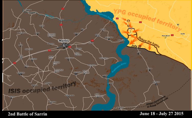 | ||
Sarrin (Arabic: صرين, also spelled Serrin or Sareen) is a town in northern Syria, administratively part of the Aleppo Governorate, located northeast of Aleppo. It is situated 3 kilometers east of the Euphrates River, south of Kobanî and east of Manbij. As a preliminary result of the ongoing Syrian Civil War, Sarrin today is situated in Kobanî Canton within the autonomous Federation of Northern Syria – Rojava framework.
Map of Sarrin, Syria
In the 2004 census, the town of Sarrin had a population of 6,140, while the Sarrin subdistrict had a total population of 70,522 mostly Arab.
During the Syrian Civil War, the Islamic State of Iraq and the Levant seized control of the town in September 2013. In March 2015, Kurds in the People's Protection Units (YPG), alongside Free Syrian Army (FSA) rebels, launched an attack to take control of the strategic town.On July 27, 2015, the town was under the control of Kurdish YPG forces.