
Area 2,141 km² | Capital Puerto Viejo de Sarapiquí | |
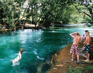 | ||
Points of interest La Selva Biological Station, Sarapiqui Outdoor Center, Dave & Dave's Costa Ric, Frogs Heaven, Mirador Prendas | ||
Sarapiquí is the tenth canton in the province of Heredia in Costa Rica. The canton covers an area of 2,140.54 km², and has a population of 49,327. The capital city of the canton is Puerto Viejo.
Contents
Map of Heredia Province, Sarapiqui, Costa Rica
The canton includes the major portion of the Sarapiquí region, and is named for its major waterway, the Sarapiquí River, which forms the canton's eastern border. The western half of the canton gives way to the San Carlos Plain (Llanura de San Carlos). Heredia's provincial border with Alajuela, which runs through the middle of the San Carlos Plain, marks the canton's western limit. The southern boundary of the canton is established by the Río Virgen (Virgin River).
The canton of Sarapiquí is subdivided into 5 distritos (districts).
- Puerto Viejo
- La Virgen
- Las Horquetas
- Llanuras del Gaspar
- Cureña
History
The canton was established by law on November 18, 1970.