
Country Philippines Barangays Area 60.7 km² Province Isabela | Founded 1855 Time zone PST (UTC+8) Local time Wednesday 3:36 PM | |
 | ||
Region Cagayan Valley (Region II) District 1st District of Isabela Weather 26°C, Wind S at 8 km/h, 91% Humidity Neighborhoods Calinaoan Norte, Calanigan Sur | ||
Santo Tomas is a 4th class municipality in the province of Isabela, Philippines. According to the 2015 census, it has a population of 23,005 people.
Contents
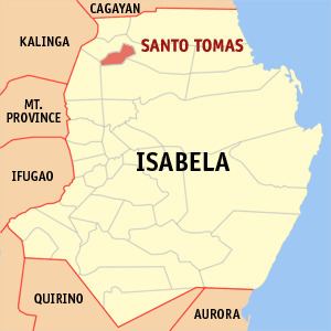
Map of Santo Tomas, Isabela, Philippines
In 1952, Santo Tomas lost 2 barrios when the barrios of Abut and Minagbag were transferred to the newly created town of Mallig. In 1961, those barrios were transferred to the newly created municipality of Quezon
Livelihood
Farming is its primary source of income. The most widespread plantations were rice, corn and tobacco farms. Locals also raise livestock for extra income.
Barangays
Santo Tomas is politically subdivided into 27 barangays.
References
Santo Tomas, Isabela Wikipedia(Text) CC BY-SA