
Length 287 km Countries Brazil, Argentina | Source Conceição do Mato Dentro | |
 | ||
Main source Conceição do Mato Dentro | ||
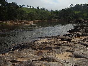
The Santo Antônio River of Brazil rises in the Espinhaço mountains, in the district of Santo Antônio do Cruzeiro, city of Conceição do Mato Dentro, in the Brazilian state of Minas Gerais. Running to the east, after a journey of 287 km, will pour its waters into the Rio Doce.
Contents
Map of Rio Santo Ant%C3%B4nio
The bandeirantes used the river as a transportation route during the Brazil Gold Rush. Today it is used for fishing and gold panning, as well as leisure and tourism.
The Santo Antônio River is notable for its rocky course with a number of waterfalls, including Bahia Falls and Tabuleiro Falls (rated in the 2005 edition of Guia 4 Rodas as the prettiest in Brazil).
Cities of the basin of Santo Antônio River
References
Santo Antônio River (Doce River) Wikipedia(Text) CC BY-SA