
Founded February 6, 1962 Time zone PET (UTC-5) Elevation 79 m | Capital Santa Rosa UBIGEO 150139 Area 21.5 km² | |
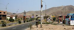 | ||
Santa Rosa is a district of the Lima Province in Peru. Officially established as a district on February 6, 1962, the current mayor of Santa Rosa is Luis García Villacorta. The district's postal code is 38.
Contents
Map of Santa Rosa District, Peru
Geography
The district has a total land area of 21.5 km². Its administrative center is located 79 meters above sea level.
Boundaries
Demographics
According to a 2002 estimate by the INEI, the district has 5,896 inhabitants and a population density of 274.2 persons/km². In 1999, there were 5,249 households in the district.
Festivities
References
Santa Rosa District, Lima Wikipedia(Text) CC BY-SA