
Demonym(s) Santafehanon Area 28.05 km² | District 4th District of Cebu Time zone PST (UTC+8) Local time Wednesday 8:08 AM | |
 | ||
Barangay Weather 27°C, Wind NE at 8 km/h, 81% Humidity Neighborhoods Kinatarkan, Maricaban, Okoy, Talisay, Pooc, Poblacion | ||
Santa Fe is a 4th municipal income class municipality on Bantayan Island in the province of Cebu, Philippines. According to the 2015 census, it has a population of 28,603. In the 2016 electoral roll, it had 16,929 registered voters.
Contents
Map of Santa Fe, Cebu, Philippines
The municipality's territory occupies the southeastern portion of Bantayan Island (marching with the municipality of Bantayan), together with the islands of Guintacan (or Kinatarkan), Hilantagaan and Hilantagaan Diot. Because the island's airport and principal ferry port are both located within the municipality, Santa Fe is considered the gateway to Bantayan and its islands.
Barangays
Santa Fe comprises 10 barangays:
Demographics
In the 2016 electoral roll, it had 16,929 registered voters, meaning that 59% of the population are aged 18 and over.
Economy
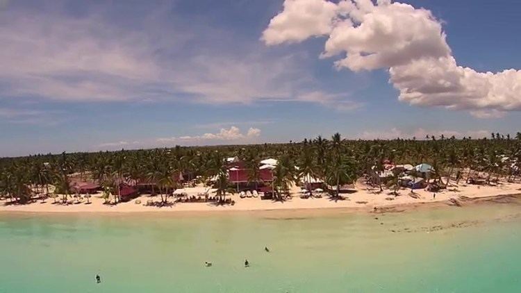
Although there is some small-scale industry, the municipality's principal source of income is fishing and agriculture, and from holidaymakers who come in large numbers, most notably during Holy Week, to enjoy the particularly fine white sand and uncrowded beaches.
Transport
Bantayan Airport, serving the whole Bantayan Island, is located in Santa Fe, although there are no scheduled flights. The town can also be reached by ferry from Hagnaya Wharf in San Remigio, Cebu.