
Comune Venice | ||
 | ||
Similar Venetian Lagoon, Vignole, Mazzorbo, Pellestrina, Burano | ||
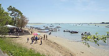
Sant'Erasmo is an island in the Venetian Lagoon lying north of the Lido and north east of Venice, Italy.
Contents
Map of Sant'Erasmo, 30141 Venice, Italy
HistoryEdit
The island was a port attached to Murano in the 8th century, but is now known for market gardening. Ruined fortifications, including the so-called Torre Massimiliana (Tower of Maximilian), ring the isle. Forts existed in the island as early as the 16th century. After the fall of the Republic of Venice, the French built here a stronghold in 1811-1814. After Napoleon's defeat, the Austrian Archduke Maximilian of Austria-Este had a tower built here in 1843-1844, and also found here refuge during a revolt. The tower has a polygonal base of 25 m and is surrounded by a ditch. On the upper floor up to 13 cannons could be housed. It was used by the Italian Army as late as World War I.
TodayEdit
An annual boat race takes place during the summer. Sant'Erasmo is also known for the waders on sand banks in the lagoon surrounding it.