
Population 540 (2006 census) Location 28 km (17 mi) from CBD | Postcode(s) 2172 Postal code 2172 | |
 | ||
Sandy Point is a suburb in south-western Sydney, in the state of New South Wales, Australia 28 km south of the Sydney central business district, in the local government area of the Sutherland Shire.
Contents
- Map of Sandy Point NSW 2172 Australia
- Residents of Sandy Point
- Newsletter
- Sandy Point Progress Association
- Surrounding communities
- References
Map of Sandy Point NSW 2172, Australia
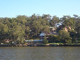
Sandy Point is also a geographical formation on the southern bank of the Georges River, east of Deadmans Creek. The Sandy Point estate was created here in 1925 and it was later adopted as the suburb’s name.
Sandy Point only consists of three streets; St George Crescent, Bingara Drive and Gambier Avenue.
Sandy Point has a Community Hall with squash courts and dancing classes, a Sandy Point Rural Fire Brigade Fire Station, local bus stop, and a park with a playground.
The suburb is surrounded by bushland in the National Park which is a popular destination for bushwalkers.
Local residents worked together to create a community mural which is now on display at the Community Hall entrance.
Residents of Sandy Point
There have been many residents of Sandy Point over the years. Some have moved on, and some are still living in the community. A Long-Time resident who most, if not all, know as the Amazing Jane Lloyd - created a Facebook Group to keep all past and present residents together and in contact and share any Sandy Point News or Events, have questions or queries or just to share photos and stories about where they are now after Sandy Point, or stories about living in Sandy Point. As of March 2014, there are 236 members.
Newsletter
Each house in Sandy Point receives a hard-copy newsletter which contains feature articles, events, advertisements for local businesses and more.
Sandy Point Progress Association
The Sandy Point Progress Association (SPPA) is the local community association providing a forum for discussing local issues that are important to the residents of Sandy Point and lobbying those responsible for change to keep Sandy Point the great community it is today.
Residents have a say in what should be done within our local community. Meetings are 2nd Monday of every Month (except January) at the Sandy Point Community Centre and all are welcome.
Surrounding communities
Holsworthy and Pleasure Point are the adjacent suburbs. Voyager Point is also a neighbouring suburb, along with Hammondville, Wattle Grove, Moorebank, Menai, Lucas Heights, Barden Ridge, Bangor and Alfords Point. Further down and neighbouring is Heathcote, Engadine and Waterfall.
East Hills and Picnic Point are located on the opposite bank of the Georges River. There is currently no vehicle access to cross the river apart from the M5, Newbridge Road or Alford's Point Road.