
Local time Tuesday 1:11 PM | ||
 | ||
Weather 9°C, Wind W at 24 km/h, 56% Humidity | ||
Sandy Lane is a small village situated between the towns of Chippenham and Devizes in Wiltshire, England, and between the villages of Bromham and Derry Hill on the A342 road.
Map of Sandy Lane, Chippenham, UK
It is 3 km south of the old Roman Road running from Bath to London, now the A4 road. A Roman villa site and a settlement called Verlucio are nearby.
The village is largely in the civil parish of Calne Without; the boundary of the parish of Bromham runs immediately to its west. Wiltshire Council is the unitary authority which is responsible for all significant local government functions.
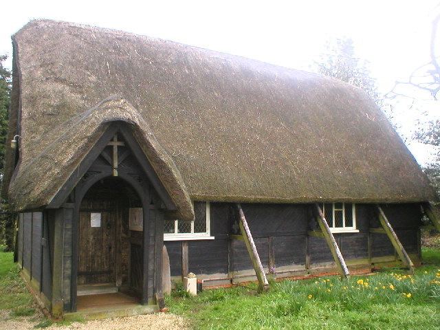
Sandy Lane has several well-preserved thatched cottages. The church of St Nicholas is also thatched.
There is a public house, the George Inn.
References
Sandy Lane, Wiltshire Wikipedia(Text) CC BY-SA